Appalachian Trail Journals: Georgia, North Carolina, and Tennessee
These journals were originally published on my Instagram between May 16 and June 3, 2021.
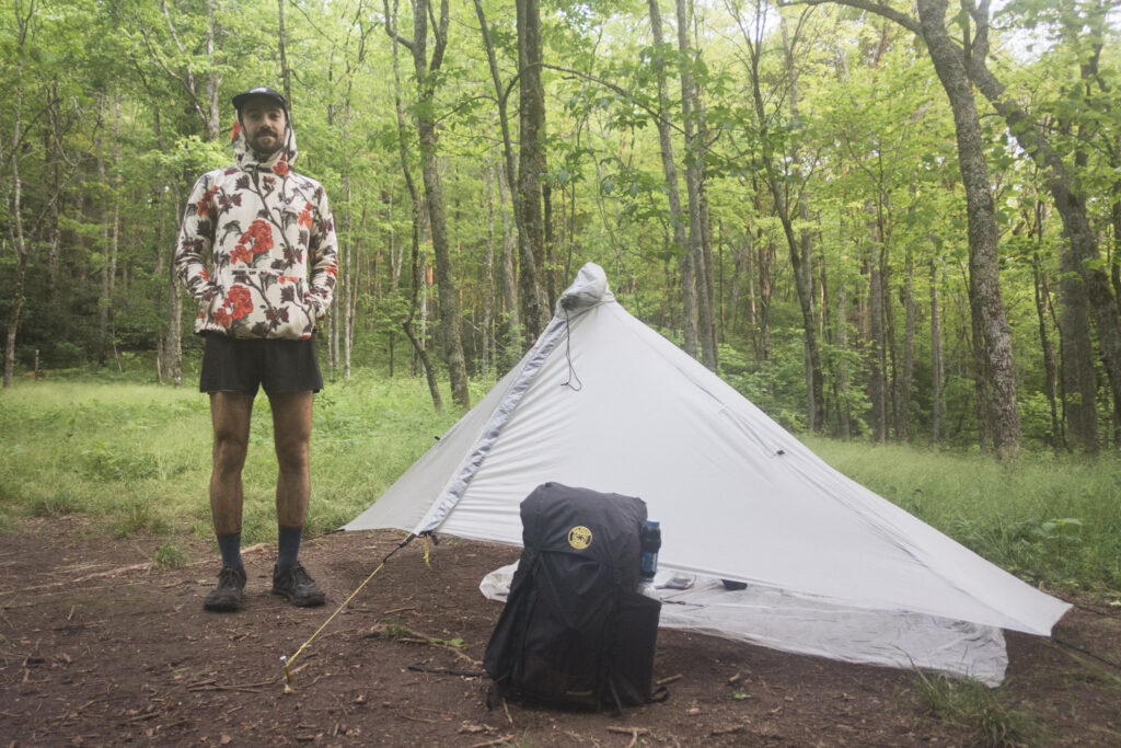
Day 1 | 1 mile
I’m thankful that the circumstances in my life and the world came together for me to go on a long hike this year, and I’m fortunate enough to find myself in Amicalola Falls State Park starting a thruhike of the Appalachian Trail today.
A long day of flights and driving with Ron’s Hiker Shuttle meant that I didn’t actually make it to the trailhead until after sunset, so I only did a mile by headlamp to make it out of the park boundary and find a flat spot to set up. Weird to start a big trip with night hiking.
It’s going to take a few nights to get used to sleeping with all the noises of the forest around me again, but I had a magical moment as I was curling up to sleep where I noticed dozens of glowing fireflies surrounding my campsite. I’ve never seen them before and they made me feel calm and happy.
Day 2 | 30 miles | Approach + 21
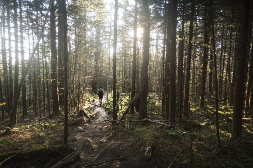
With all the ideal weather, beautiful terrain, and banter with other hikers, my first full day on trail was a great one.
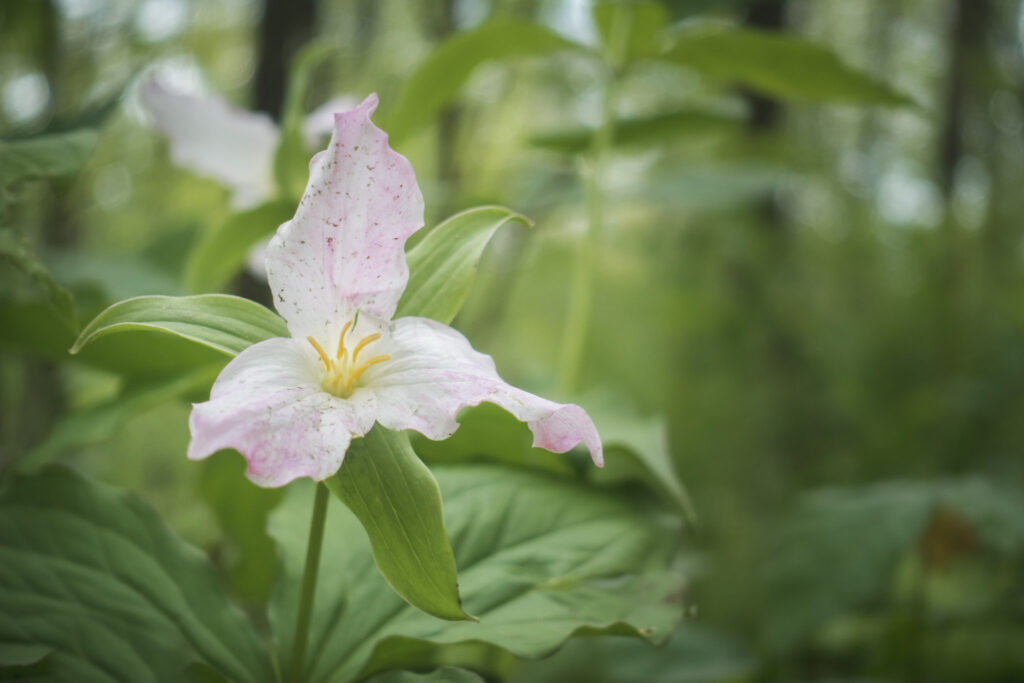
While the beauty of the Appalachians is subtler than the mountain ranges out west, it’s not at all hard to appreciate how nice it is out here. Open views of the landscape have been few, but the forest itself is wonderful. It’s so full of life and activity, with birds and critters of all kinds constantly talking away or zipping all around. And being here in May means that I’m treated to wildflowers and trees blooming in shades of orange, purple, and white, although I don’t recognize most of the plants.
One of my biggest stresses coming into this hike was that I would get rained on constantly, but the forecast is mercifully clear for my first week, allowing me to ease into this thing and enjoy it.
The path has been gentle and the walking pleasant so far, and I’m excited to see what the trail has in store for me coming up. I’m not sure how my body will respond to this kind of mileage, but I don’t mind giving it a shot.
Day 3 | 27 miles | 21-48
I didn’t sleep well again because of some strong wind that was howling through my campsite all evening, shaking the trees, making noise, and generally making things stressful. I could really feel the sleep deprivation affecting my hiking today, so hopefully I can get some good rest soon.
First thing this morning, I went up Blood Mountain, my first proper mountain of the hike. Unfortunately, I was in the clouds at the summit so there were no views. But I did enjoy the sight of the impressive stone shelter at the top.
After heading back down the mountain, I passed through Neels Gap, where there was a great little store with friendly staff that gave me an opportunity to pick up some supplies and eat a pizza. As I was sitting there eating my pizza and chatting with other hikers, I noticed I felt much better immediately, ready to tackle the afternoon.
The rest of the day, I cruised up and down the peaks along a ridge line, pretty well the high point of the area. Instead of being deep in the forest like I was yesterday, I was up high today, peaking out at the sky and distant landscapes through the gaps in the trees below me.
I set up my shelter for the first time on this trail tonight, hoping that the walls might help me sleep. But I managed to pick a super windy campsite again. Here’s hoping I can sleep through it better the second time.
Day 4 | 21 Miles | 48-69
Most of the locals I’ve made small talk with in the last few days have made some remark about it being a “great day”. Sometimes I react skeptically like I think they’re joking or being falsely positive, because the weather is just cloudy and kind of blustery. But then I realized that for people around here, if it’s neither raining nor super hot, it’s a great day. There’s probably a valuable lesson for me in there.
I spent most of the day going up and down the ridge lines of Tray Mountain, catching a few glimpses of the landscape around, but mostly just admiring the different wildflowers surrounding the trail. Today also brought the first few challenging uphill climbs of the trail, getting me to really work up a sweat.
At Dick’s Creek Gap, I had to roadwalk to the Hostel Around the Bend to pick up a resupply box, but I decided to end my day early and stay the night, resting my tired feet. I had a really nice evening eating dinner, drinking wine, and socializing with all the other hikers enjoying a relaxing stay at the hostel.
Day 5 | 27 miles | 69-96
I woke up at my hostel this morning, grabbed my bag, and hit the road with a cup of coffee to go before I could get vortexed into a full morning of breakfast and relaxation with the other hikers.
Not long after I started, I crossed the state line into North Carolina. It was a nice little psychological victory to walk past a milestone like that. I felt thankful for the Georgia Appalachian Trail Club for making the AT through Georgia some of the most well built and maintained trail I’ve ever walked on.
The transition into North Carolina was intense, as I immediately went up the steepest climb of the trail so far to the summits of Sharp Top and Courthouse Bald. It was tough hiking, made tougher by the hot sun and my pack which had just been resupplied and was weighing me down. I wondered if this was a sign of what was to come for the rest of the state.
Turns out that the trail chilled out for my afternoon hiking, staying relatively flat over sunny ridge lines. I hung out over lunch in a shelter with a 70-year old retired doctor named Mike who had some great stories and perspectives on hiking.
I set up for the night at a picturesque sight near the top of Little Ridgepole Mountain, as usual picking a campsite with good sunset views at the price of colder temps and no water source.
AT Day 6 | 26 miles | 96-122
I woke up around sunrise at my campsite on Little Ridgepole Mountain after my first good sleep on trail, finally feeling rested for the day ahead. Maybe cowboy camping on a ridge felt like home and helped me relax.
The day started off with really pleasant, easy hiking in the cool morning temperatures, but the intensity quickly ramped up as I worked towards the top of Albert Mountain. The climb was short but steep, and I quickly found myself at the summit fire tower. The view from the top of the steps was a beautiful panorama in all directions, the first of my journey on the AT, but it wouldn’t even be my last of the day.
The middle of the day was hot and sweaty, the first time of this trail that I really needed to wear sunglasses and sunscreen, and I felt like I was drinking water nonstop all afternoon.
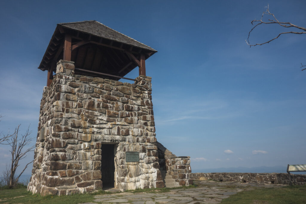
In addition to the heat, I thought the long, steady ascent up to Wayah Bald was one of the most physically demanding things I’ve done so far on the AT. But I was rewarded at the top with a lovely old stone fire tower, and another 360-degree panorama view of the landscape.
I ended my day camping at Licklog Gap with a group of four women just out for a relaxing overnighter away from their families. It was nice to join them for dinner, but I left them to enjoy their social campfire together as I hit they hay at hiker midnight (9pm).
Day 7 | 23 miles | 122–145
The day started with a trip up to the top of the Weser Bald fire tower, where I had a really nice chat with a retired sheriff from Florida who was vacationing and dayhiking in the area with his son. We talked about retirement and hiking and all enjoyed the endless panoramic views in all directions. I’m loving these North Carolina fire towers!
After the fire tower, the trail descended thousands of feet right on the ridgeline of Fork and Paint Mountains, with open valleys to the left and right. It made for stunningly beautiful but very challenging hiking on the technical terrain in the exposed sun.
I eventually descended far enough to get back into the lush forest, thankful for the shade and being treated to the sight of gorgeous trees blooming in white and pink.
My destination for lunch was the Nantahala Outdoor Centre, a tourist attraction for both river paddlers and vacationing families. I literally smelled the deep fryer from a quarter mile away. When I finally made it down, the culture shock of having tourists, businesses, and cars all around me was extreme. It’s always bad after days in the backcountry, but I think it was even worse for me this time because of Covid-19, given that crowds like this haven’t really existed in Canada – where I’m from – for over a year.
I managed to calm down and enjoy a delicious sandwich and beer at the patio bar on the banks of the Nantahala River while I took a break to recharge my electronics. Afterwards, I charged up the ascent out of the valley, full of energy after my break and meal. It was hard work, but I eventually made it to the summit of Cheoah Bald, where I set up at a picturesque campsite with sunset views.
Day 8 | 27 miles | 145-172
I woke up today earlier than usual and enjoyed a gorgeous sunrise from my campsite on Cheoah Bald. After I finally got going. I met and walked with a 70-year old section hiker named Sherpa who told me about all the beautiful things I have to look forward to in Tennessee and Virginia.
The descent down into the Fontana Marina, where I would do my next resupply, was brutally steep. So by the time I made it down there, my legs were fried and I was happy to relax for a bit drinking beer on the dock watching all the fishing boats go in and out. I hung out and drank with a hiker from Alabama named Hawkeye and we talked about photography, thruhiking, and pretty much everything in life. It was one of those on-trail conversations where you seem to cover more ground than is possible in other social settings.
But eventually it was time to stop chatting and relaxing and get on my way. I said goodbye to Hawkeye and walked across the Fontana Dam, which was an epic structure. Being a Sunday evening, the area was quiet and peaceful.
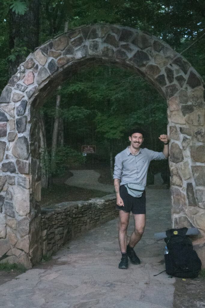
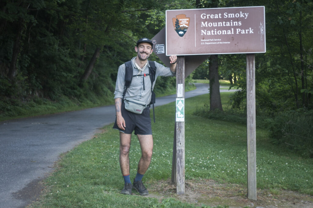
To mirror my steep descent into Fontana, my welcome to Great Smoky Mountains National Park was a tough uphill climb, pretty much the last thing I wanted to be doing at the end of a long day. But I grinded my way up, and met up with a hiker named Spirit who walked into camp with me. We shared a very quick dinner before hanging up our bags on the bear cables and heading to sleep.
Day 9 | 31 miles | 172-203
I woke up after a bad night’s sleep, frustrated with the group that hiked into the campground well after dark, loudly waking everyone up. But the frustration was quickly forgotten as I enjoyed some of the most diverse wildlife I’ve ever seen in a day in the backcountry. Today really made it feel special to be in a National Park.
First thing, the bird song and woodpecker noises that greeted the sunrise seemed louder than they had before I got into the Smokies. Afterwards, I hadn’t walked more than a few miles before I was startled by the sight of a bear running away from me down the hill. Clearly it had noticed me before I noticed it.
Unlike the perceptive bear, a few miles later, I walked right up to a group of big wild pigs munching on grass not far from the trail, no idea I was around. I suddenly had memories of people telling me stories about aggressive wild pigs, so not knowing what else to do, yelled “Yo!” at them, causing them to startle and run off up the trail.
To end the day’s wildlife viewings, I saw a few different groups of turkeys walking around, honestly more beautiful than I imagined turkeys to be.
My day’s hiking brought me along the forested ridges that make up the border line between North Carolina and Tennessee. The big finale of the day was summit of Clingmans Dome, actually the highest peak on the whole Appalachian Trail.
Unlike many of the peaks I had summited recently, Clingmans had a unique observation tower along with a huge curved concrete ramp that made it wheelchair- and stroller-accessible for the many tourists that visit. I walked up to the top but found the environment, full of crying children and frustrated parents too stressful to enjoy. So I got the heck out of there instead of admiring the view.
I ended my day at the Mount Collins Shelter, an impressive stone structure nestled in a forest of coniferous trees that reminded me of home on the west coast.
Day 10 | 39 miles | 203-242
In Great Smoky Mountains National Park, hikers are required to stay in designated sites instead of wherever they please like on most of the Appalachian Trail. Today, there was an additional challenge for me because the site I would have naturally picked was closed, meaning I had to go further than usual for the day. I hit the trail just after dawn, eager to get going and move quickly, stressed about the idea of taking too long and getting into camp after dark.
Late morning, as I was walking through Newfound Gap, a scenic road crossing, I said hello to a big multi-generational family out for a day hike. We exchanged the usual pleasantries and they seemed very impressed at my plan to walk all the way to Maine. It was pretty similar to dozens of other conversations I’ve had until, after we had said goodbye, the grandmother of the family, named Nancy, came running back to me trying to get my attention. She had this wonderful sweet smile that made me trust whatever she was about to say.
When she finally caught up, she caught me off guard by asking if she could pray for me. I assumed she meant like, at home later on and told her sure. But then she surprised me again by taking my hands in hers and closing her eyes, asking God to watch over me and keep me safe during my hike.
While those words themselves didn’t mean as much to me as I’m sure they did to her, the fact that this complete stranger that I had only talked to for two minutes was putting so much care and warmth into my walk was enough to almost bring me to tears. We said goodbye again and I was fired up to continue my day!
That interaction, plus the exhilarating trail, built right into the spine of the mountain range, kept me moving quickly and efficiently all day. At the end of it, I amazed myself by arriving at Davenport Gap Shelter, my intended destination for the day by 6:30pm, with hours of daylight ahead of me. That got me fired up once again, and I decided to carry on the additional 4 miles to the hiker hostel Standing Bear Farm, where hot food, cold beer, and new friends awaited.
Day 11 | 22 miles | 242-264
After waking up at the Standing Bear Farm hostel, I hung around sipping coffee and socializing, eventually getting moving later usual. I paid the price for my late start, because the heat and humidity had already ramped up by the time I hit the trail. I felt like the temperature especially affected me since I had gotten used to the cool breeze in the Smokies above 6,000 feet, but I was walking around 3,000 feet this morning.
I’m not sure if it was due to the heat, fatigue from my big day yesterday, or weird sleep in the hostel bunkhouse, but I really felt like I had no energy today. My legs and feet fortunately felt healthy, but I just couldn’t really get them going all morning.
The afternoon’s walking took me up to the summit of Max Patch, one of the most iconic locations on the Appalachian Trail. It’s a mountain with a huge grassy field on top, making for unobstructed views in all directions. I was lucky enough to get there on a sunny afternoon, so I took the opportunity to relax and refuel while admiring the landscape.
After being up on mountain ridges for the past week, I had forgotten what I was missing down in the lower elevation rainforests. The dense tree canopy and sound of flowing creeks sure makes for a sense of tranquility and comfort.
I never really ended up feeling energized all day. But the amazing thing about thruhiking is that if you just keep moving, even slowly, you can cover a surprising amount of ground over the course of a day. So despite the lack of bounce in my step, I kept plodding along, content with the calm landscape, until I finally made it to a good campsite for the evening on the summit of the unremarkable Bluff Mountain.
Day 12 | 10 miles | 264-274
Finally, my first sweet, glorious town day.
I woke up before dawn after a pretty great sleep, my campsite cushioned below by a bunch of dead leaves, and sheltered above by rhododendron. Instead of waiting for the sun, I just decided to get going, doing the first few miles of the day by headlamp.
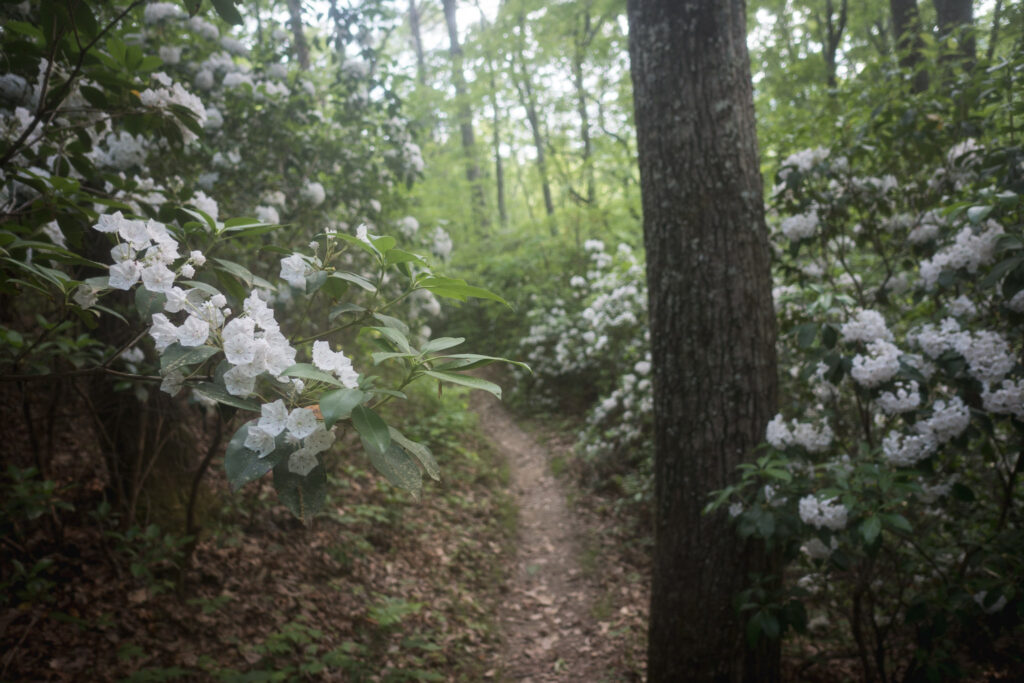
The morning’s hiking was all cruisey downhill, as easy as can be. I was motivated by the thoughts of the luxuries of town ahead, and the gorgeous blooms of mountain laurel that surrounded both sides of the trail on the way down made the experience feel like the finishing chute of a race.
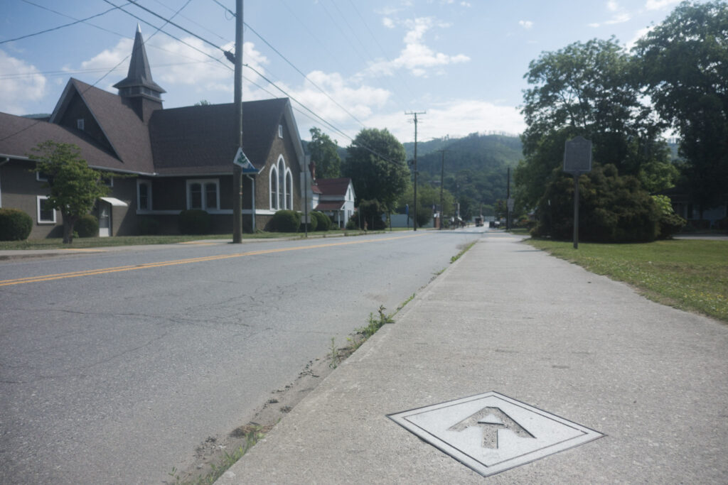
By late morning, I had made it into the town of Hot Springs, NC, the centre of which the Appalachian Trail passes right through. My first stop was the Smoky Mountain Diner where I ate a breakfast skillet bigger than my head to sate my hiker hunger, which is starting to ramp up. After that, I checked into the Iron Horse Station, a hotel built in the 1890’s which is now literally right on the AT.
Today’s objective is to just put my feet up and recharge mind, body, and soul for the hiking ahead.
AT Day 13 | 35 miles | 274-309
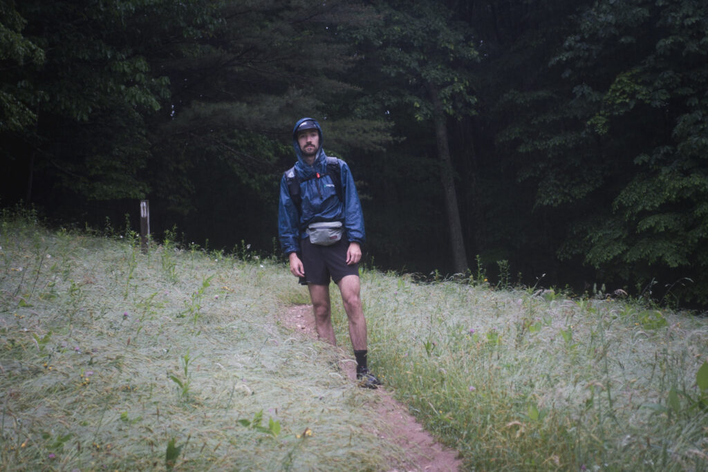
I woke up early in my room in Hot Springs, drank about a litre of coffee, and then hit the trail instead of hanging around in town. It started as a relaxing walk along the French Broad River before heading up into the mountains right in the middle of a raincloud.
I finally got rained on today after 12 dry days on the AT. While sunny breaks in the morning gave me hope that the rain might never materialize, I had no such luck. My instinct when faced with rain while backpacking is to panic, so I had to remind myself that all my sensitive gear was sealed in ziplocks or trash bags and that I had nothing to worry about. I also remembered the classic ultralight backpacking line “You know your skin is waterproof, right?”
It was such a hot day that I continued through the rain in my shirt and shorts, and the weather thankfully cleared for my time high on the ridge of Firescald Knob, a mountain with really impressive panoramic views on all sides.
The rain did leave behind some really high humidity, which completely zapped my energy all afternoon.
As I walked into the evening, the weather cooled off, which made me feel more energetic, but unfortunately the rain came back. I walked until around sunset and by the time I set up my tent it was really coming down. I crawled in and tried to relax but started to really freak out when I realized that it was raining so heavily that it was splashing on my sleep system, probably partly because I didn’t pitch my tent very well, and partly because it may not be really designed for such heavy rain.
I managed to at least calm my panic, but shit, I think this could be a rough night. Why didn’t I stay at the shelter a few miles back like a normal person?
Day 14 | 35 miles | 309-344
After my little meltdown last night when I realized rain was splashing onto my sleep system, I managed to readjust, stay dry, and have a surprisingly good sleep. But the experience was a humbling reminder that I’ve far from mastered this thing.
I was disappointed to wake up to more rain with no signs of letting up. Not wanting to set up my soaked tent for a second night, I realized that if I really hustled today, I could make it to a hostel, which would give me a chance to dry off and reset.
So I committed to that goal and walked through the full day of rain in the forest. It was pretty miserable, to be honest. But I made good time and focused on my goal. I also had to keep myself from eating all my snacks at the beginning of the day, because apparently my hiker hunger has taken hold.
At the end of the day, it actually stopped raining and the environment was quite pleasant. The final descent into town gave great views across the Nolichuky River valley, but I was eager to make it down instead of stopping to admire them. By that point, the skin on my feet was in rough shape because of all the mileage in wet socks.
I managed to make it to Uncle Johnny’s Hostel outside of Erwin, Tennessee before dinner. Now that I’ve had the opportunity to reset and dry off, I’m looking forward to the days of hiking ahead.
Day 15 | 26 miles | 344-370
I got a slower start than usual today, waiting for the resupply store at Uncle Johnny’s Hostel to open. But that was probably a good thing, forcing me to recover from yesterday’s big day. I relaxed by hanging out on the banks of the Nolichuky River drinking coffee and eating Pop Tarts.
Once I got my resupply, I started walking the relaxing trail along the river where I crossed paths with families vacationing at the nearby resorts. Eventually, the trail climbed higher up away from the river and the tree canopy thinned out. As it went up, the white blooms of mountain laurel that I’ve enjoyed almost every day recently lined both sides of the trail once again.
It looks like the season for the mountain laurel blooms is coming to an end, but the blooms of pink rhododendron are just beginning. At home, I’ve mostly thought of rhododendron as little decorative bushes, but they’re one of the most common plants I’ve seen on the Appalachian Trail, some of them twice as tall as me, and I can’t wait to see what it looks like when they’re all flowering.
For the rest of the day, I went up and down over grassy bald summits, and up and down in and out of the fog, giving the day a mysterious vibe. It felt like I had the forest to myself all afternoon, and that the fog muted the sounds around me. The only things to listen to were my own footsteps and the occasional woodpecker going to town on a tree trunk.
At the end of my day, I set up my tent next to the Clyde Smith Shelter and ate dinner with a big group of friendly thruhikers, mostly from Seattle. I think they were high and it was entertaining for me to listen to them figure out their bear hang for over half an hour as I got ready for bed.
Day 16 | 28 miles | 370-398
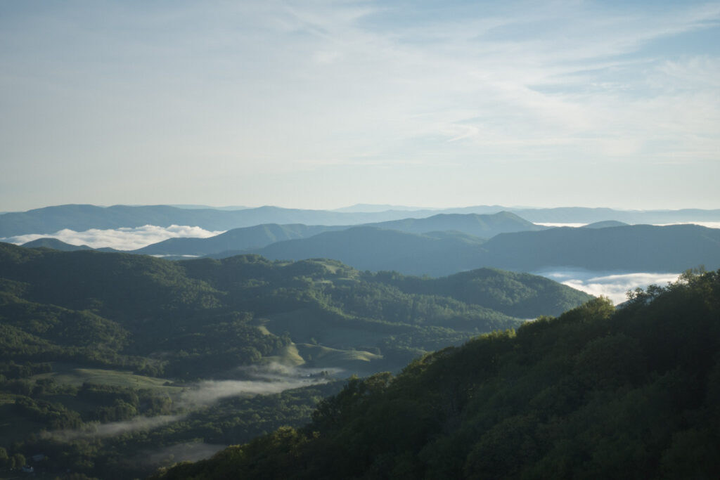
I woke up this morning after my coldest night on trail so far, really having pushed the limits of comfort for my sleep system. But the discomfort of the night was soon forgotten as I climbed to the top of Iron Mountain and witnessed a spectacular cloud inversion that got me excited for the day ahead.
The chill of the previous night persisted, and I hiked with my fleece on all morning and spotted a few groups of deer running away from me along the trail. Or maybe they were the same deer all morning criss-crossing my path.
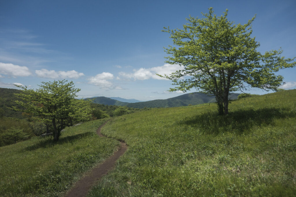
Once I passed the scenic road crossing Carver’s Gap, the views opened up, but the trail got busy enough with dayhikers out enjoying Memorial Day to make me uncomfortable. Eventually the crowds did thin out, and I was treated to walking up and down grassy balds one after the other, each more scenic than the last. It was a really special afternoon of hiking.
After I finally left the views (and the state of North Carolina) behind, I made it to the Mountain Harbour Hostel to resupply and relax. It was one of the best setups for hikers I’ve ever seen, with an outdoor bar, food truck on site, and waterfall features surrounding the big fire pit.
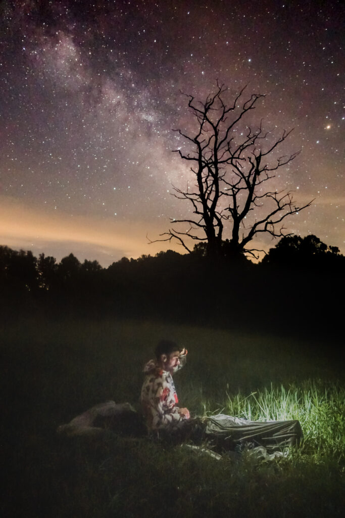
The vortex, trying to pull me in to stay for the night, was strong, but I surprisingly resisted and hiked out after approximately three dinners and as many beers. By headlamp, I made my way to a campsite on a scenic meadow where I hoped to stargaze on this rare clear night.
Day 17 | 22 miles | 398-420
I woke up with the sunrise today in my scenic meadow campsite, unfortunately finding that my sleep system was soaked through with condensation. But it wasn’t all that unexpected, and just the price I had to pay for sleeping under the stars out in the open. All worth it, though.
The walking was easy and pleasant all morning, and really all day. It felt less like I was in the backcountry and more like I was skirting the edges of civilization in rural Tennessee. The forest was quiet and peaceful, and I was happy to have a relaxing day of hiking over the easy terrain.
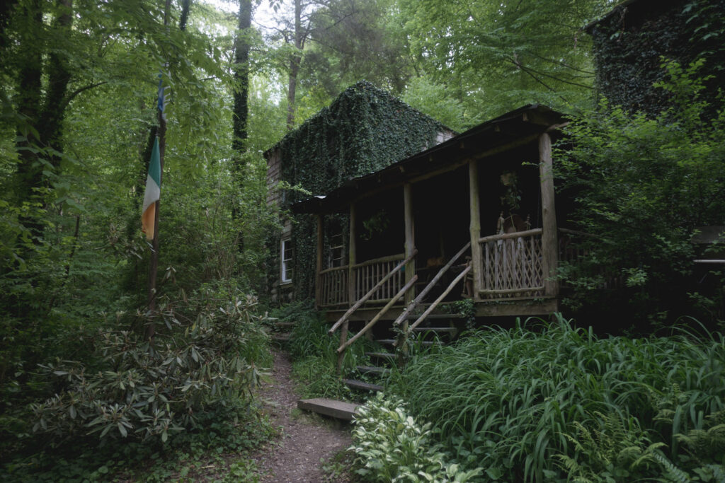
The highlight of my day was arriving at the rustic Kincora Hiker Hostel, run by the legend of Appalachian Trail maintenance and hosteling, Bob Peoples. It was a real pleasure to sit around in the living room and listen to Bob talk about his experience hiking all over the world, and all the hikers he’s hosted and befriended over the years.
Bob stayed up with me and a couple other hikers until after dark, telling stories about other legendary characters of the trail like Earl Shaffer and Baltimore Jack, giving me a window into this odd and beautiful community that surrounds the trail I’ve been living on the last couple weeks. He was kind, incredibly generous with his time, and I felt like I could have listened to him talk for hours.
The day was very different from my others so far, and I was happy for it.
Day 18 | 32 miles | 420-452
I woke up at the Kincora Hostel earlier than all the other hikers, in time to see Bob feed a raccoon that lives on the property and apparently comes to the porch every morning to eat. Bob shook my hand and wished me off with the advice “Don’t chase the bears, they were here first!”
The walking for the day started in the beautiful valley created by Laurel Fork, much of it on trail blasted right out of the side of the canyon. The highlight was the impressive Laurel Falls, which I had all to myself.
I left Laurel Fork and cruised around the banks of the Watanauga River for the rest of the morning until I climbed up onto a ridge above the river, where I would stay for the rest of the day.
The ridge was a beautiful place for a trail, and I really wanted to feel excited for the way the terrain fell away from me on both sides, and how the cool breeze flowed though the trees around me. But I just had this major lull in energy all afternoon and felt like I couldn’t get going again, physically or mentally.
I finally got fired up late in the day while listening to a Backpacker Radio podcast interview with Clara Hughes about her journey from competitive sports to a practice of mindfulness on trail. Listening to her talk about backpacking was like flipping a switch in my brain that produced all kinds of extra energy in my body.
The day ended on an unexpected fun note with easy walking through pastures where cows contentedly munched on grass and didn’t seem to care much about me passing by. I set up my tent near the Double Spring shelter, but didn’t get to socialize since all the hikers inside were already asleep when I arrived.
Day 19 | 19 miles | 452-471
I woke up feeling excited, as I always do on the morning of a town day. I was also relieved it wasn’t raining while I packed up despite that being the forecast.
Most of the walking for the day was on a forested ridge, just like yesterday. The brush in the area was thick enough for me and a couple of black bears to scare the mutual shit out of each other since neither of us apparently noticed the other coming until we were almost on top of each other.
I enjoyed the easy, mostly downhill walking towards town, even when it eventually started raining. Since I knew I would be in a dry room that night, there was nothing to stress about, and I enjoyed the sensation of the cool drops on my skin and the noise of the rain hitting the leaves above me. When the tree canopy is as thick as it is on the Appalachian Trail, it’s amazing how dry a hiker can stay walking through the forest.
I had one of the weirder animal sightings of my life when I came across a housecat walking the trail, nowhere near a house. Not sure what it’s deal was but I hope it’s okay.
I finally made it out into the town of Damascus, Virginia in the early afternoon. It’s a lovely little town with beautiful homes and an historic downtown. It even has the first supermarket I’ve visited since starting the AT, and the experience of walking in and seeing all that food was surprisingly overwhelming and emotional after being in the backcountry eating crackers and noodles for a few weeks.
I settled in to my comfortable room at the Dragonfly Inn, where I look forward to refuelling and letting my body recover for the miles ahead.
Read the next chapter of my Appalachian Trail journals from Virginia, West Virginia, and Maryland here