Appalachian Trail Journal: Virginia, West Virginia, and Maryland
These journals were originally published on my Instagram between June 4 and June 26, 2021.
Day 20 | 27 miles | 471-498
I got a late start today, opting to eat a big breakfast at the Damascus Diner to end my visit to the town. It was hard to be in anything but a good mood, because everyone in Damascus was so friendly. I guess sometimes I worry that locals in these trail towns would get tired of all us dirty hikers coming through and stinking up the place. But I’ve learned that in a lot of these towns where the resource extraction industries that led to their establishment have dried up, ecotourism is now the biggest driver of their local economy. So they really are happy to see us and help out on our journey
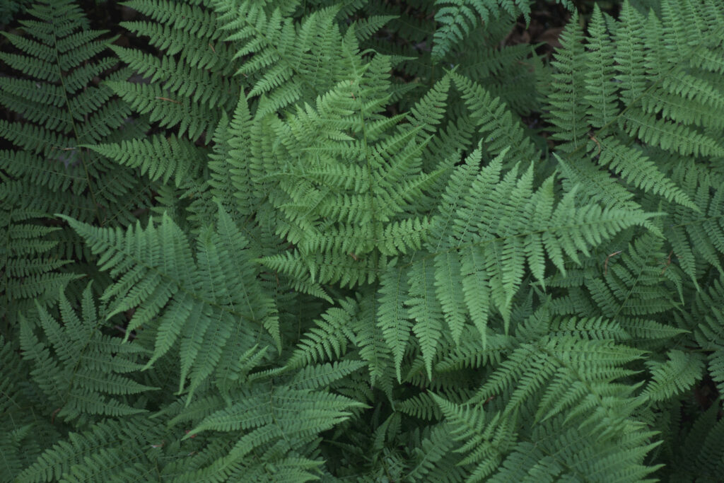
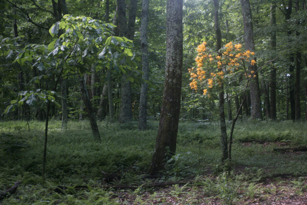
Once I started, the forest was incredibly lush and green after the recent rain. I found myself stopping over and over just to take pictures of the ferns that blanketed the forest floor. I also enjoyed the sight of old railway trestle bridges through the area, now being used for the Virginia Creeper Trail, the local cycling route.
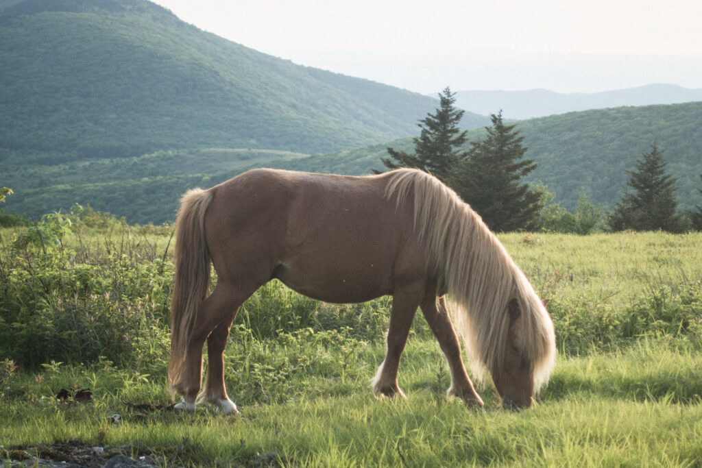
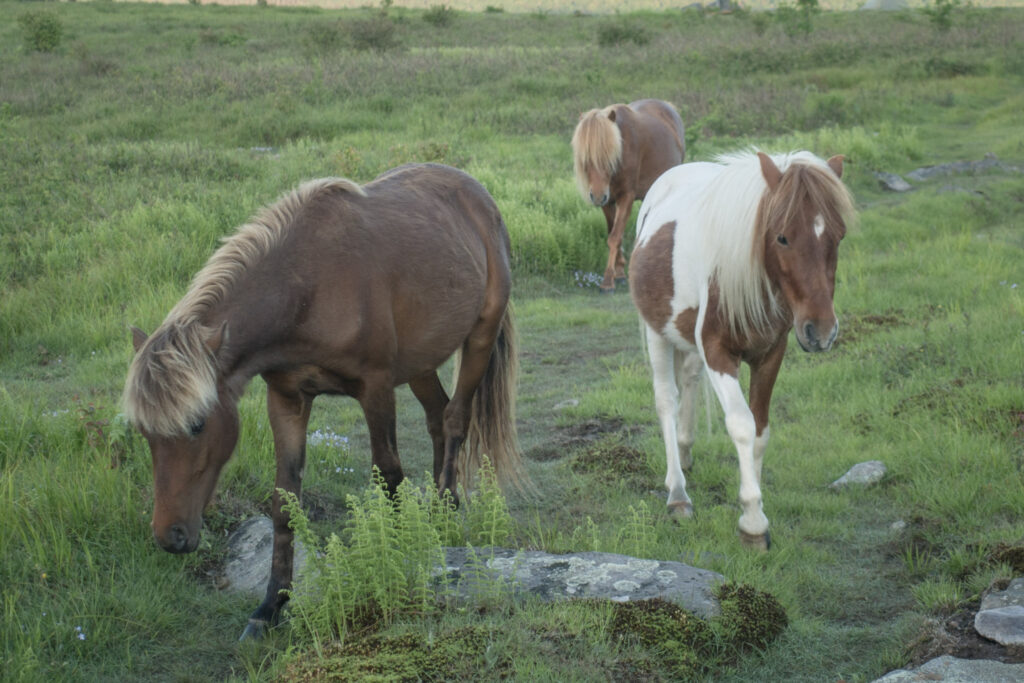
The highlight of my day was definitely coming to my campsite in an open meadow of the Lewis Fork Wilderness and seeing three wild ponies, glowing in the golden light of the last hour of the day. The ponies weren’t shy at all. One of them ran right up to me to lick the salt off my skin! I could hardly keep her away!
Relaxing in the meadow watching the sun set with the ponies munching grass around me is an experience I won’t soon forget.
Day 21 | 30 miles | 498-528
I woke up in my campsite in the meadow not having slept all that well because of the ponies grazing all around, sleeping beside, and even licking my tent at all hours. But it was a special night and I felt fortunate to have experienced it.
The few miles north of where I slept were the busiest with other campers that I’ve seen anywhere on this trip so far, filled with backpackers checking out the ponies or getting ready to summit Mount Rogers, the high point of Virginia.
I spent the whole sunny morning walking through the mountainous meadows of Grayson Highlands, which were like something out of a fairy tale. Wild ponies grazed and frolicked around, and even sometimes expected me to give way to them while they walked up and down the Appalachian Trail.
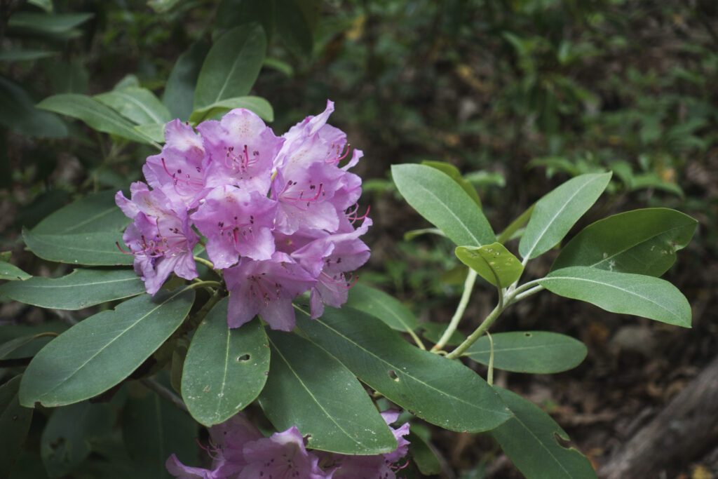
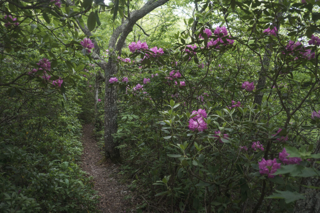
Eventually I made it out of the highlands and into the forest, where I found a lot of solitude and quiet. It really was just me and the birds and chipmunks for most of the day. I loved climbing up to the forested ridge in Raccoon Branch Wilderness, where blooming rhododendron lined the trail in pink.
I ended the day walking through a cow pasture, where I found a nice boulder to sit and relax. It occurred to me that leisurely sitting in a cow pasture was a very funny way to spend a Saturday evening. It’s hard to imagine myself choosing to do that on purpose in my off-trail life, even though it felt so nice today. But because it was a rest stop on my big walk to Maine, it was a totally wonderful and even normal thing to do in this silly culture I’m a part of.
Day 22 | 28 miles | 528-556
I started my day today similarly to how I had begun yesterday, a peaceful solo walk between just me and the forest critters. I even had a funny quarter hour or so where a mama dear and an adorable fawn kept running away from me, but because they stayed on the Appalachian Trail, I just kept coming after them. They finally figured it out.
Late morning I started passing a ton of hikers, probably because so many of them stayed at the impressive Partnership Shelter. I guess the system of shelters on the AT ends up creating these bubbles of people, and it’s noticeable when I end up within one.
In the afternoon it rained a little bit and then became super hot and humid for the rest of the day as I walked over easy terrain of rolling hills through pastures. If this is the type of hiking that Virginia has in store for me, I welcome the change.
Crossing under Interstate 81 was noisy and chaotic, but I was stoked about the surprise opportunity to buy a cold beer at a truck stop during the hottest part of the day.
I celebrated passing the quarter way point of my thruhike by ending my day at the appropriately named Quarter Way Inn, a hiker hostel made out of a big old farmhouse. I stayed up chatting with the other hikers until after sunset, and then went out on the porch to see the beautiful show put on by fireflies in the pastures around me before heading to sleep.
Day 23 | 25 miles | 556-581
I was fortunate to be able to start my day sharing a wonderful breakfast with the other hikers staying at the Quarter Way Inn. Our host Tina cooked up a great homemade spread, including honey from hives right on the property.
I gained elevation all morning through pastures and forests until making it to the rim of Burke’s Garden, a huge valley formed by a limestone sinkhole. After I got to the rim, I followed the AT along a ridgeline for the rest of the afternoon, much longer than I expected given the distance. The trail up on the ridge absolutely kicked my ass with tough walking, hot temperatures, and no water.
The thing that finally got my butt into gear late in the day was the sound of booming thunder in the distance behind me. I saw sunny skies ahead and thought I might be able to outrun the storm if I hustled. I wouldn’t end up being successful.
The arrival of the storm was dramatic. First, the wind picked up and leaves started falling out of shaking trees all around me. Then it got so dark it felt like I needed my headlamp despite sunset being hours away. And then it started to pour.
The rain that came down this evening was some of the heaviest I’ve ever been in, completely soaking me through from head to toe within just a couple of minutes. There was no real alternative but to just keep walking, so I carried on until finally collecting some water from a stream and making it to the first decent campsite.
Of course, the moment I finished getting my tent set up, the rain stopped and the evening sun peeked through the trees.
Day 24 | 31 miles | 581-612
It was pretty unpleasant starting the day by putting on my clothes that were still wet from yesterday’s storm, but I was thankful that it wasn’t raining this morning. Even better, the sun was out most of the day which gave me a chance to dry off.
I stopped for lunch and resupply at the remote deli / general store called the Brushy Mountain Outpost. It was fun to sit in there and listen to the locals interact, getting a glimpse into what daily life is like in the tiny town of Bland, Virginia. To be honest, the accents were so thick that I could only make out about half of what was being said, but I know that it involved farm equipment.
Despite my experience on drier trails than this, the sparseness of water access the last couple days has challenged me, especially with the heat and humidity every day. I found myself pretty thirsty more than once today.
At the end of the day, thunder boomed in the distance, making me worry about a repeat of yesterday’s downpour, which I really didn’t want to get caught in. So I hustled to find a camp spot with some water and found myself down a short side trail to the beautiful Dismal Falls swimming hole, with good tenting all around. I enjoyed my dinner next to the waterfall and then managed to get my tent set up just in time before the rain came, but it ended up being just a drizzle.
AT Day 25 | 24 miles | 612-636
I got started a little after sunrise today and had a really peaceful and enjoyable start to my day, feeling like I had the whole forest to myself. As hot as it’s been lately, it’s great to get a bunch of miles done before the sun gets too high in the sky. The only part of waking up early that’s not fun is clearing out the spider webs across the trail with my face for a few hours. I hope the people behind appreciate what I do for them every morning.
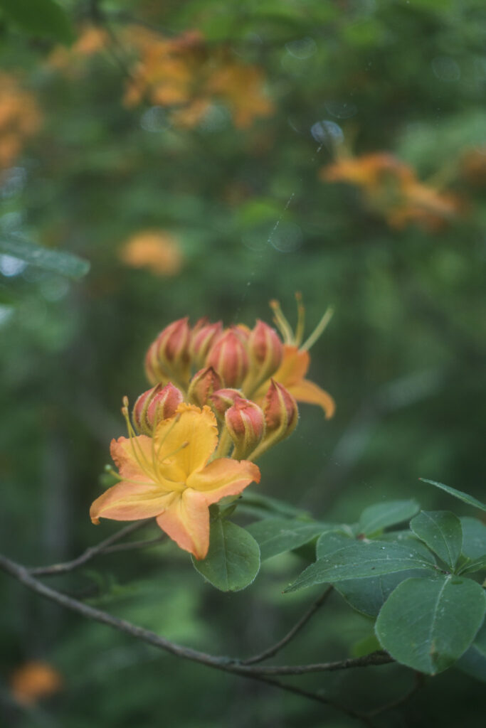
The peaceful morning came to an end with a tough climb climb out of the lush forest and up to higher elevations where I was rewarded with expansive views of Wilburn Valley from the top. As I gained elevation, I traded the bigger trees for blooming shrubs. The orange azaleas, pink rhododendrons, and white mountain laurel all complimented each other and created a gorgeous canvas of colours around me.
Time passed by quickly, as it always does on a town day. In the afternoon, I descended into the shaded forest and eventually emerged into the streets of Pearisburg, Virginia where I decided to stay the night, resupply, and eat Mexican food.
Day 26 | 23 miles | 636-659
After getting a slow start to my morning in Pearisburg, it was a jarring experience for my first couple miles to be along or around the noisy highway and local chemical plant, where announcements over the loudspeaker for employees were loud enough to be heard from the forest all around.
I eventually made it into the mountains where I left behind the noise of civilization but traded it for the sound of approaching thunderstorms. I got dumped on pretty hard and soaked through as I was climbing up towards the Rice Field Shelter, but the sun came out by the time I had made it up to the ridge.
It would alternate between clear skies and rain for the rest of the day, with the booming of distant thunder threatening me from all sides until the evening. I’m learning to be stoic about this kind of weather, and I think I’m starting to get pretty good at it. It’s just water, after all, and it’s thankfully been hot enough out that staying warm hasn’t really been a factor. It’s probably some useful lesson in taking things as they come and not stressing about things I can’t control.
I walked through one last deluge in the evening before making it to my peaceful camp along Big Stony Creek just as the sun was coming out to end the day.
Day 27 | 24 miles | 659-683
Progress was slow this morning walking on the ridge above Bailey Gap. Although the elevation profile in Virginia has been relatively gentle, the trail’s been rougher, narrower, and more overgrown, making the hiking challenging.
I enjoyed a relaxing lunch break sitting on a beautiful wood bench in the sun at War Spur Shelter. It’s a pretty simple thing, but when you’ve been in the backcountry for a few days, a nice bench to sit on can feel pretty special. Afterwards, I was fortunate to meet a guy named Mapless at the next trailhead who was handing out cold Cokes to hikers. He had just finished hiking a section of trail nearby and decided to stick around to do some trail magic.
I walked through pastures most of the afternoon and it was sunny and hot, but dark storm clouds were hanging out in all directions and closing in. By the time I climbed up to the Eastern Continental Divide in the evening, it was clear I wasn’t going to escape them. It sadly started pouring on me at pretty much the worst possible time, which is right before I got to camp. Getting rained on isn’t so bad, but putting on wet clothes first thing in the morning tomorrow sure will suck.
The last few days, I’ve been trying to manage some pain at the front of my ankle. But today I started to worry that it’s not going to go away as easily as the other little niggles I’ve dealt with so far. I’ve figured out a little rehab routine which I’m trying to be optimistic about, but this thing is weighing heavily on my mind and is really taking a toll on my morale along with the weather.
Day 28 | 22 miles | 683-705
After putting together the willpower to put on all my wet clothes and head out into the morning rain, the hiking started slow for the day once again up on the Eastern Continental Divide. The trail traced a route on big angled rock slabs that were slick from all the rain, so I walked cautiously to avoid slipping
Late morning both the rain stopped and the trail got much easier, which were together a huge boost for me psychologically. Only problem is that my shoes and both my pairs of socks were soaked from the cumulative days of rain with no way to dry them off in this humid weather. My feet are starting to look like those of an old wrinkly man who has been in the bathtub for too long, and it’s not comfortable
The climb up to the scenic rock formation called the Dragon’s Tooth was about 2,000 ft, a lot for Virginia standards, but I found it pleasant because the sun was out and the trail was in good shape. The Tooth itself was very impressive.
From the summit, I was hungry and excited to descend, but the trail down was very challenging, verging on scrambling. Despite my bad luck with weather the last couple days, I felt very fortunate I was doing this steep, technical section in the sun.
I finally made it out to the road in the early evening and headed directly to the Catawba Grocery for dinner and resupply. After that, I walked up to the Four Pines Hostel to relax and stay the night. I met a lot of hikers there who experience the trail very differently than me, with less daily mileage, more partying, and more time hanging out in hostels. I felt like it was important for me to dip my feet into this side of the Appalachian Trail every once in a while.
Day 29 | 25 miles | 705-730
I woke up just after sunrise at the Four Pines Hostel to not only the usual sounds of birds chirping, but also the rooster crowing and, unexpectedly, a cat meowing outside my tent. Despite all the racket, everyone else seemed to be sleeping in, so I packed up and set off on my own into the fog through pastures and forest. Because camping in this section of the trail is limited to designated sites, I really did have about six miles of the AT all to myself this morning, and it was peaceful and pleasant.
After passing the trailhead at VA Route 311, I had the complete opposite feeling. That section of trail, which I walked through in the late morning, was the approach for McAffee Knob, a popular destination for dayhikers. The trail widened out and was relatively packed with big groups.
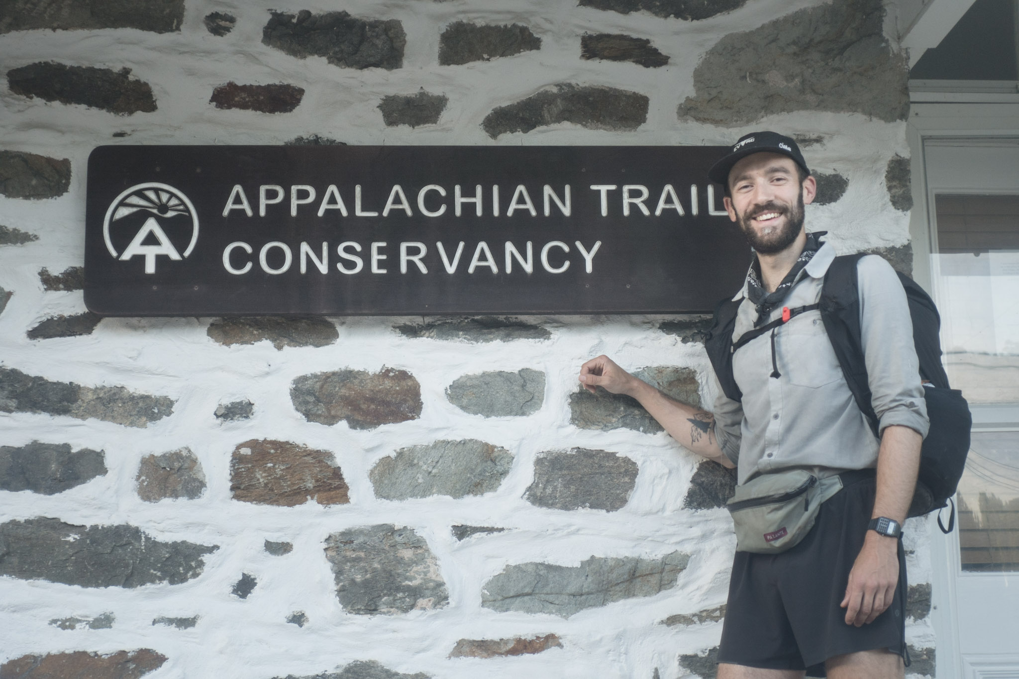
The lookout at the knob was beautiful, but too hectic. So I took my cliché AT thruhiker photo and moved on. A few miles later, the trail ran right along the edge of the equally scenic Tinker Cliffs, which were much quieter because of the longer access. I had the whole view to myself, except for a couple of vultures. I watched them dry their wings in the sun, but put them away and do something else every time clouds passed by. They reminded me of a thruhiker finding a sunny spot in the afternoon to dry off their wet tent.
I made my very long, gradual descent towards town throughout the rest of the day, first on a sunny ridge with partial views on both sides, and eventually through shaded forest. I hardly saw anyone at all in the second half of my day, a stark contrast to the busyness of McAffee. I eventually finished my day in the town of Daleville, where I really looked forward to resting up.
Day 30 | 0 miles
Day 31 | 26 miles | 730-756
After a full day of hanging around the motel in Daleville yesterday, I was excited to get back on trail this morning. While we’re hiking, we can find ourselves daydreaming about being in town for the clean linens and cold beer and other comforts. But the irony is that after a couple hours of enjoying that stuff, we realize that walking around in the forest is way more fun.
I started my day walking along and under the noisy interstate, taking a couple hours to really feel like I had made it out of civilization. But once I did, it was a really peaceful day. I had the beautiful and somewhat strange experience of walking all day on the AT and only seeing four people: three dayhikers and one picnicker.
Towards the end of my day, the trail paralleled the Blue Ridge Parkway, a scenic road that’ll run close to the AT for the next few days, providing opportunities for some nice vistas with developed picnic areas. I enjoyed spotting hawks floating around on thermals throughout the afternoon.
I made camp at a quiet spot on the ridge of Cove Mountain, where the breeze and clear skies made for a much cooler evening than the muggy ones I had gotten used to the last week or so.
Day 32 | 29 miles | 756-785
I guess I needed the rest, because I slept in over an hour past sunrise this morning, not hitting the trail until much later than usual. Once I did get moving, it ended up being my most social day of hiking so far.
I started my day by bumping into Stanley, a hiker who amazingly walks in flip-flops and has been at about the same pace as me for the last few hundred miles. We’ve said goodbye to each other about a half dozen times by now but keep reuniting.
I said goodbye to him once again late morning so that I could head into the Middle Creek Campground, where I had a package with new shoes and a new water filter waiting for me. I enjoyed a giant cup of coffee and a couple orders of homemade biscuits at the camp store while I opened my box and waited for my gizmos to charge.
Equipped with my new gear, I felt like a new man and hit the trail reinvigorated and met up with Liam, who I first saw at Standing Bear hostel and also started his thruhike in mid May. We hiked through most of the afternoon together, pushing the pace up the big climb on Apple Orchard Mountain and bonding over our similar thruhiking styles.
Liam and I said goodbye in the evening so that he could make a big push to get into town tonight, while I continued at a more relaxed pace into the James River Face Wilderness. From up high, I enjoyed views of the James River valley in the golden light of the setting sun while I made my way down to the Matts Creek Shelter to spend the night.
Day 33 | 29 miles | 785-814
I started my day today by crossing the James River an an impressive 1000-foot long steel truss footbridge. I was thankful and amazed that people go through the trouble of building structures like that just for people to walk on.
On the north side of the river, I continued on a wide, pleasant trail on the shaded banks of Rocky Row Run until bumping into Stanley once again. Together, we pushed the pace up the steep climb to the summits of Little and Big Rocky Row where we were rewarded of gorgeous views of the James River valley we had come from.
The rest of the day I hiked on my own through the heat in the partially shaded forest. At the Lynchburg Resevoir, I finally got to swim for the first time since starting this hike, which was refreshing but very muddy. After the swim, I enjoyed walking along Brown Mountain Creek, where stone remnants of walls and chimneys left clues about a community of freed slaves that lived in the area until the 1920s, according to a sign I read along the way.
The hardest part and also highlight of the day was the climb up Cole Mountain, which took a lot of effort at the very end of the day. But the panoramic views from the top, where I watched the sunset light up the sky in orange and pink, were sensational.
Day 34 | 30 miles | 814-844
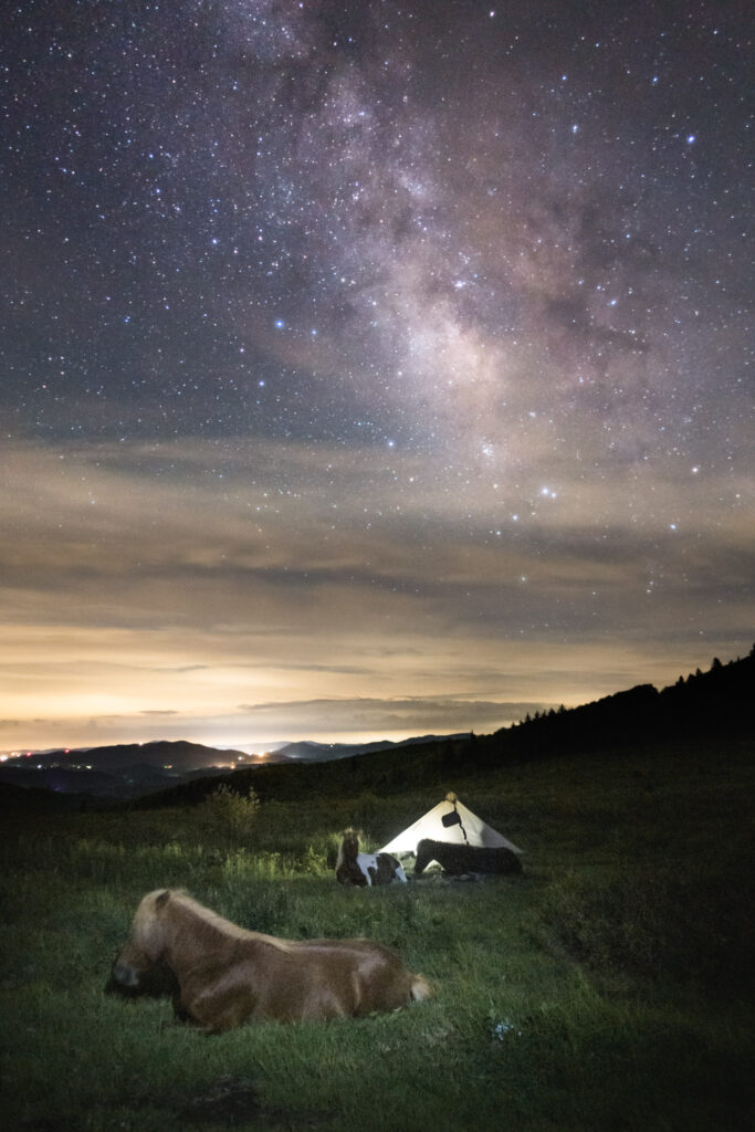
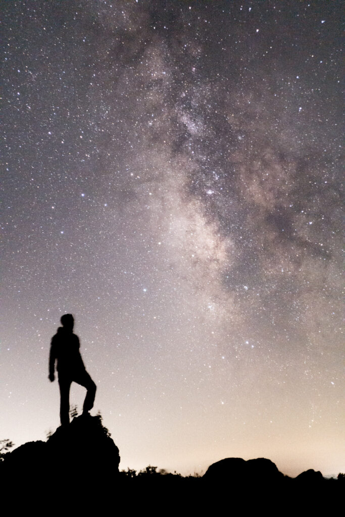
I didn’t sleep much last night because my plans to wake up and take pictures of the night sky after the moon set kept me nervously awake like an excited kid on Christmas Eve. But I got the shots I wanted, and I was fired up psychologically when I woke up around sunrise, despite the lack of sleep.
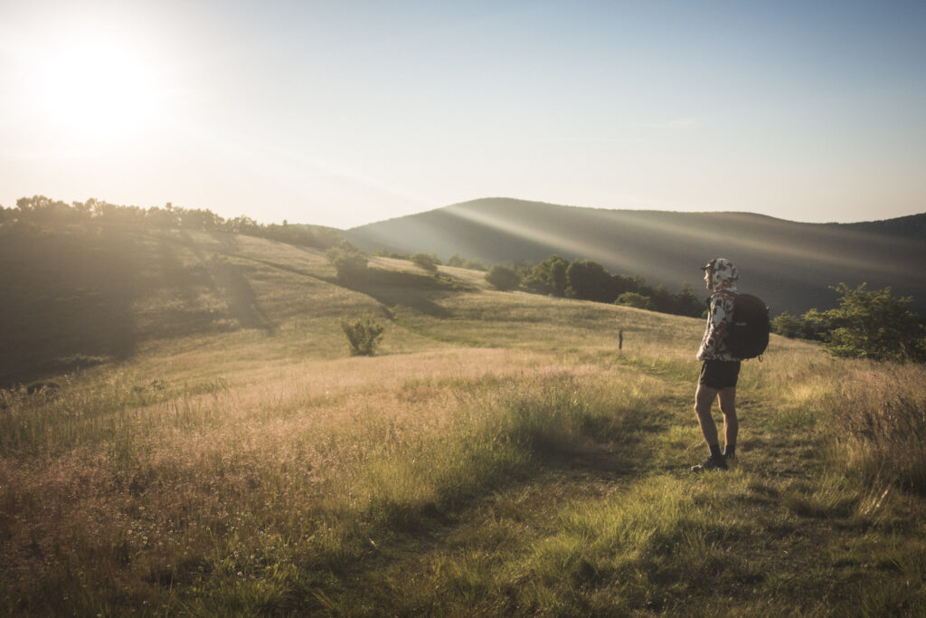
Seeing the golden light of the rising sun hit the grassy summit of Cole Mountain was a great way to start the day. Sweeping views of the Virginia landscape both ahead and behind me were beautiful.
I stayed at high elevations in the cool breeze for most of the morning and into the afternoon, until I passed over the high point of The Priest Wilderness. From there, the descent down towards the Tye River was so far that my water bottles crushed themselves from the higher air pressure at the bottom.
And the change in temperature as I descended was wild, too. So even though the river was too shallow for swimming, I couldn’t resist dipping half my body into the refreshing water to cool off before the big climb out of the river valley.
As expected, the climb up to Three Ridges kicked my ass because of the incline and technical terrain, but summiting was a rewarding accomplishment with which to finish the day’s walking. As the sun faded, I descended down to Maupin Field shelter in that state of blissful exhaustion that comes readily at the end of a long day on your feet.
Day 35 | 31 miles | 844-875
After some tough hiking the last few days, it was such a joy to start my day walking on the wide and relatively flat trail in the Humpback Rocks area. I flew past dayhiker after dayhiker, really noticing the smell of their laundry detergent or hair products. I’m guessing that means that I’m starting to smell pretty bad.
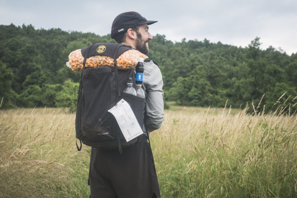
The cool breeze and cloudy skies that I enjoyed all morning eventually disappeared and the heat and humidity came to zap my energy away as I crossed the interstate in the afternoon and entered Shenandoah National Park. But before I did that, I stopped at the King’s Gourmet Popcorn food truck to eat some dinner and pick up a large bag of Chicago Mix popcorn that would be all my food for my first day the park. They made it fresh and hot right in front of me!
The biggest difference I noticed after entering the national park was the wildlife. Deers would stand right on the trail and wait until I was almost on top of them before bolting away. And bunnies were everywhere!
I ended up walking a little later than I would have liked this evening, just looking for a decent place to sleep. But that meant I was treated to the sight of the fireflies starting their psychedelic nightly show right as I was hiking through them.
Day 36 | 35 miles | 875-910
My first full day in Shenandoah National Park was a decent one. It was really hot and muggy once again, and to be honest, the trail had been kind of ugly for the first few miles since I entered the park. But I appreciated how flat and easy the walking had been. It was also fun to see all the tourists, car campers, and dayhikers have their moments of joy on this trail I’ve been living on for over a month.
In the afternoon, I picked up some snacks and cold drinks at the Loft Mountain campground, and set off up the trail reinvigorated. The trail followed a high ridge and the landscape got much more interesting than it had been yesterday or this morning. The trade off for the more beautiful views was a more physically demanding section of trail, as it usually goes with hiking, I guess. I managed to get away from the noise of the road and into some denser forest, but I sure had to work for it, especially in the humid conditions. I was soaked in sweat.
I found some extra energy in the evening after talking to Elizabeth and Bill, a dayhiking couple in their 80’s that I bumped into. They were very friendly and chatty, and Elizabeth read me a poem from her journal she had written that day on the trail, apparently only 1 of 33.
Like all these big climbs I seem to tackle at the end of the day, summiting High Top Mountain took every ounce of energy I had, but man was it rewarding. And seeing the sun set over the hazy landscape from the top was awesome.
Day 37 | 25 miles | 910-935
It was a real joy today to finally be able to really cruise on some consistently easy and flat (for the Appalachians) trail. I managed to move quickly and, as usual for this week, really work up sweat.
The most interesting part of the day was moving through the various developed parts of the park, including the Lewis Mountain Campground where I stopped for a snack and resupply. There, I learned from an information stand about the tension the opening of the park caused between the levels of government in 1936 because of the opposing views on racial segregation held by the National Park Service and state of Virginia at the time. I think it was important for me to be reminded that public lands weren’t developed from the start as places for all people to enjoy.
After that historical interlude, I hit the trail and passed more campgrounds, picnic areas, and lodges. I had decided a few days ago that I would treat myself to a room at The park’s Skyland Resort to rest and reset tonight, and I had the excellent timing of walking into the comfort of the resort just as a storm was rolling in.
After all this muggy humidity the last week, I think this is actually the most excited I’ve ever been for a shower and laundry in my life.
Day 38 | 22 miles | 935-957
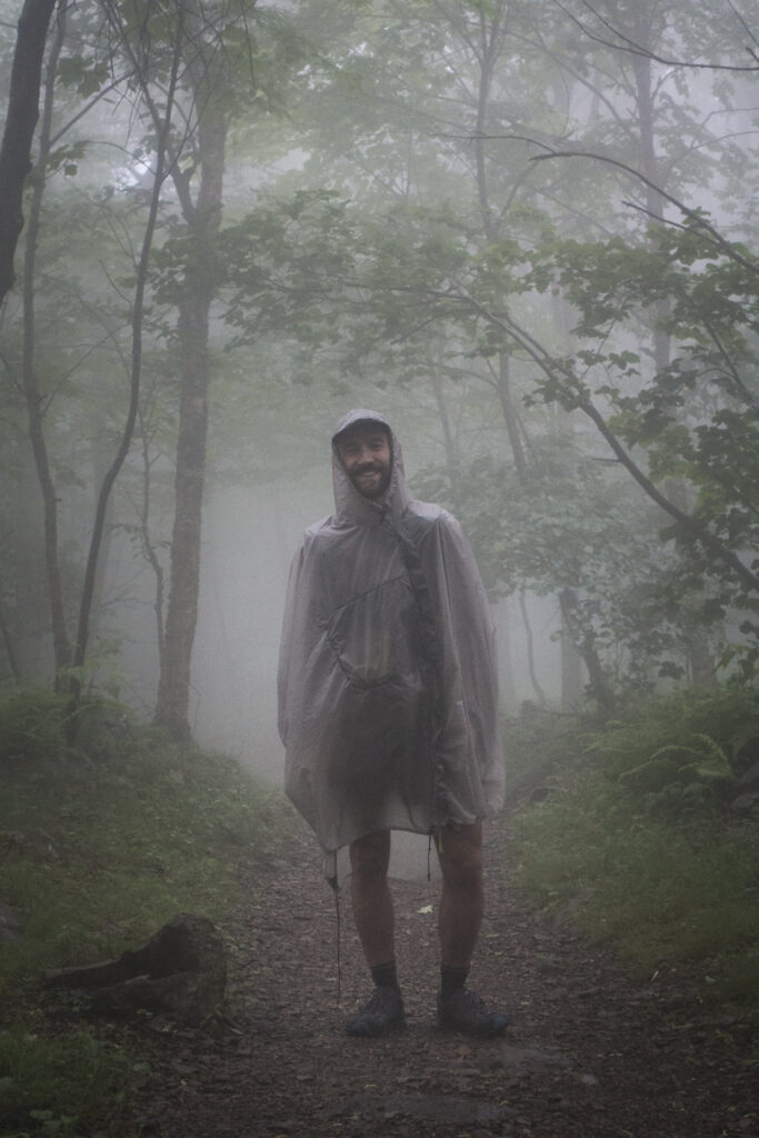
I woke up in my room at Skyland Resort this morning and looked out the window to see some pretty gnarly weather: fog, wind, and driving rain. I was thankful to be indoors for the time being, but it really surprised me how sad the weather made me, and how much I was dreading the day’s hiking.
I wasn’t about to stay another night, but I stayed in my room until the last possible minute, not wanting to leave. By the time I made the short walk outside to drop off my key, I had decided that I would hang out in the lobby until the weather passed. But when I actually put my pack on and got out there, I suddenly realized how not big of a deal the weather was. Not only that, but how much better it felt to be out in it than sitting indoors for any longer.
So I set off in the late morning and actually had a pretty good time. It was fun to wear my Gatewood Cape (a kind of poncho/tent) for the first time, and I was happy with how it performed. That piece of rain gear is named after the first woman to thruhike the Appalachian Trail on her own, using a shower curtain to keep the rain off.
Eventually, the weather did clear in the afternoon, the birds starting chirping, I took my cape off and all was as it should be. I really enjoyed walking through the shade of the young forest as the sun came out in the evening. It was a cool, comfortable few hours of hiking, and it couldn’t have ended more perfectly. As I walked past the Jeremy’s Run trailhead, I stared in disbelief at a bunch of Miller Lites that someone had left on the side of the trail, clearly as a gift to whoever walked by. They were still cold! I gave one a wash with soap for good measure and walked a few more miles, catching glimpses of the setting sun shining its golden light on the surrounding landscape. I felt just fine.
Day 39 | 31 miles | 957-988
It took me a little longer than I’d like to admit to crawl out of my bivy today, the cool morning breeze making me want to stay in the warm comfort of my sleeping bag just a little longer. I did eventually get out, and the good news was that the cool weather made for more comfortable temperatures later in the day.
My streak of good luck from yesterday continued at the Gravel Springs trailhead where I found more cans of cold beer left for hikers. It was a little (a lot) earlier than I would usually drink beer, but there are no rules about that sort of thing in the wilderness, so I enjoyed a can sitting on the cliffs of Mount Marshall admiring the view.
Most of the morning I walked on easy trails through the north end of Shenandoah National Park, crossing the boundary early afternoon. As I made my way down towards US Route 522, I looked over a sprawling property filled with unique red-roofed buildings. I was surprised to see on my map that it was the Smithsonian Zoo. I actually looked up whether I could walk over and visit, but passes were unfortunately sold out for the day.
I walked off trail to resupply at the Monterey Service Station, and the roadwalk along VA Route 55 was probably the least pleasant and most stressful thing I’ve done since starting this hike: fast traffic, no shoulder, and one very angry German Shepherd. I was relieved to make it back on trail after a few miles of that chaos and trade the noise of traffic for the noise of cicadas, which was almost as loud but a lot more calming.
I finished the last few miles of the day in shaded forest over easy terrain, and really felt thankful for a day of relief from the humidity. I set up camp for the night at the edge of a gravel parking lot in the GR Thompson Wildlife Management Area, happy to be in the open to watch the sun set and the fireflies come out.
Day 40 | 35 miles | 988-1023
I started my day around sunrise walking over open meadows and other easy terrain through Sky Meadows State Park. The way the golden light of the first hour of the day caught the blades of grass was beautiful.
I worked my way down towards Ashby Gap where I had to play a high-stakes game of Frogger to cross the busy US Route 50. Who knew the scariest thing on the Appalachian Trail would be the cars?
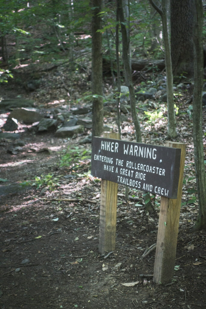
Afterwards, I passed an ominous sign warning me that I was entering the Roller Coaster, an infamous section of trail known for repetitive rocky climbs and descents of wooded summits with no views. It ended up being not quite as bad as I might have expected, but it did get pretty tiring as the heat of the afternoon ramped up towards the end.
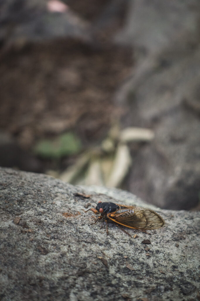
It seems like I’ve finally made it into the heart of cicada territory. I heard their hum pretty constantly today, and saw their carcasses everywhere along the trail.
The trail got quite a bit more flat and shaded after the Roller Coaster, but it stayed rocky enough for my legs and brain to be pretty exhausted by the end of the day. I got off trail at WV Route 9 for a little resupply and dinner in the evening at the Sweet Springs Store.
I hadn’t really ever intended on doing the classic AT Four State Challenge, but I ended up just naturally finishing my day today at the usual starting point of the challenge. So I’m interpreting that as a sign from the universe that I should give it a go tomorrow.
Day 41 | 44 miles | 1023-1067
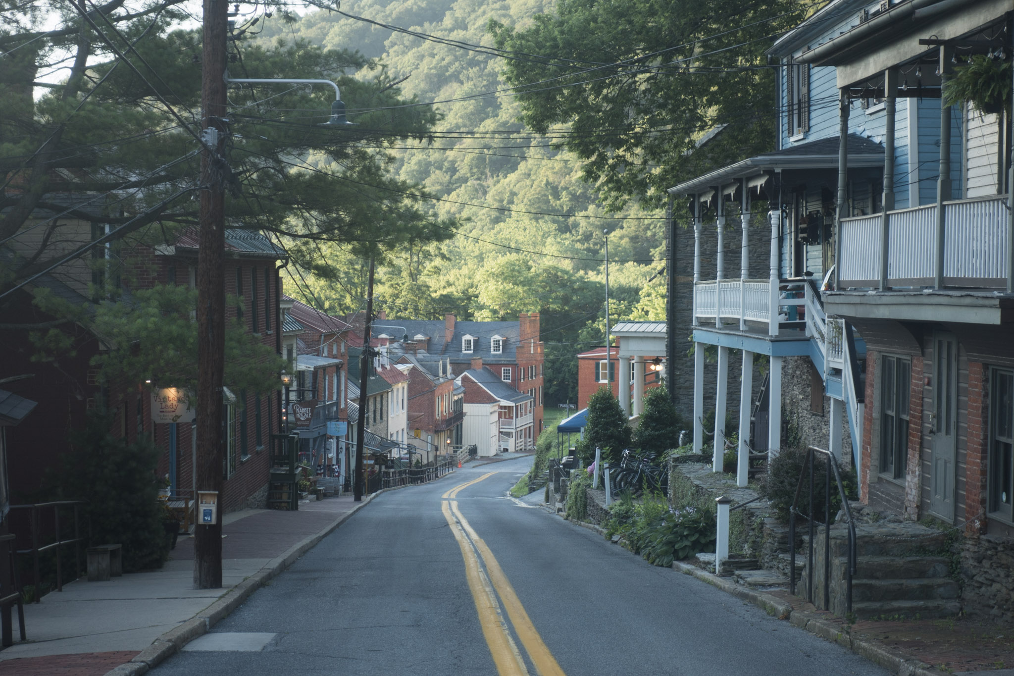
I woke up a little before sunrise right at the Virginia – West Virginia state line, having decided last night that I should give the 4 State Challenge a try, which is to cross three state lines in one day. Starting the day by crossing the Shenandoah River as the sun rose and filled the valley with pink and orange was pretty special. I walked through the cute historic town of Harpers Ferry and ended up taking my time exploring and reading about the town’s role in the Civil War. Any ambitions I had for completing the day’s challenge in a speedy time quickly evaporated, and I was happy to just be a tourist for a while.
I crossed the Potomac River into Maryland on a railway bridge well into the morning, reading more history about the development of the railway and shipping canal through the region. I even spent a chunk of the morning walking on a bike path along the canal’s towpath. As I continued north through the state parks of Maryland, I stopped at more monuments and signage to learn about the Civil War battles that were fought in the areas I was walking through. I even got to climb to the top of the original stone Washington Monument!
The hardest moments of the day came as I walked along the sunny and rocky ridge of Annapolis Rocks in the heat of the day and low on water. But as soon as the sun fell low enough for me hike in the shade, I felt my energy levels shoot right back up for the last few hours of daylight.
My lowest emotional moment came when I checked my progress as the sun was setting to find out that I still had 5 miles to go, much longer than expected. I must have slowed down more than I realized in the last couple hours. I was too far into it to give up, so I psyched myself up for some night hiking.
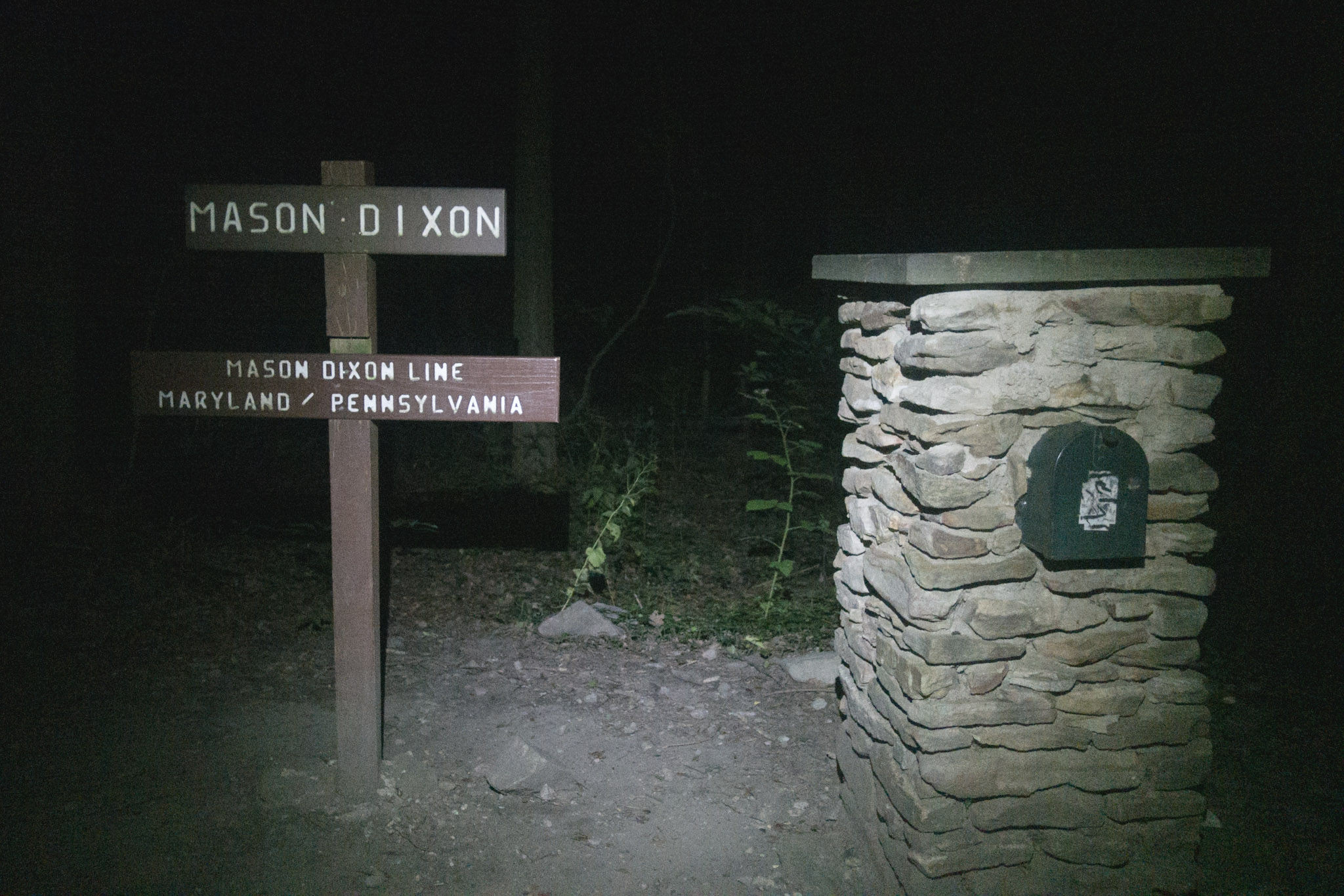
My headlamp lit up the sign for the Mason-Dixon Line just after 10pm, 16 hours and 34 minutes after I started this morning. I was pleased with the day, and it was actually some of the most fun I’ve had on this thruhike. I was pretty certain when I started that I would be able to finish this thing, but I surprised myself with how little I had to go to the well to do it.
Read the next chapter of my Appalachian Trail journals from Pennsylvania, New Jersey, and New York here