Appalachian Trail Journals: New Hampshire and Maine
These journals were originally published on my Instagram between July 24 and August 10, 2021.
Day 70 | 23 miles | 1760-1783
Cammping next to Mink Brook last night was the first time in a while that I felt cold at night. It was so dang hot throughout southern New England that I had got in the habit of choosing the coolest campsites I could find, contrary to everything I learned about backpacking out West. I don’t think I’ll be doing that anymore now that I’m in New Hampshire.
So I slept in a bit later than usual to wait out the cold, then packed up and made my way up Moose Mountain. At the top, I found myself walking through a beautiful inversion, looking at the morning sun shining down on the clouds from above. I’ve realized it’s a pretty common phenomenon out here in the Appalachians, but I’ll never not be in awe of seeing it.
On my way down Moose Mountain, I looked at the map and realized that even though it was just my first full day in New Hampshire, the White Mountains were coming at me hard and fast, and I’d be up and down peaks all day. I went up to the sunny and open Holt’s Ledge, where I took the opportunity to dry out my gear and take in the view. I descended from the ledge, took a very refreshing dip in Grant Brook, and then worked my way up Smarts Mountain.
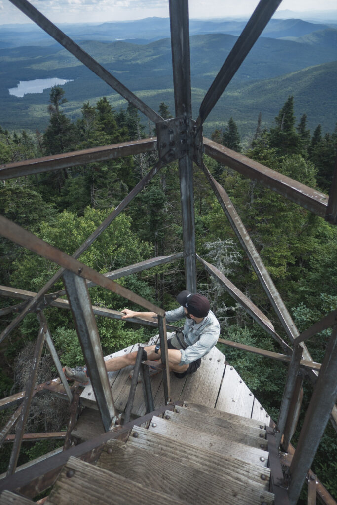
It being a sunny Saturday, I passed a ton of other hikers on the way up Smarts. But by some luck, I had the summit all to myself. I hung out in the fire tower and took in the breathtaking views in all directions.
My final objective for the day was the summit of Cube Mountain, which I summited as the sun was getting low in the sky. I took my pack off and relaxed on the rocks and was stoked to see that, looking across the landscape in front of me all the way to the horizon, I could see everywhere I had come from that day. It looked like a long way to walk.
I guess I enjoyed the view a little too much, because by the time I started to get myself off the mountain, it was getting dark. I did the last couple miles by headlamp and set up next to Brackett Brook.
Day 71 | 21 miles | 1783-1804
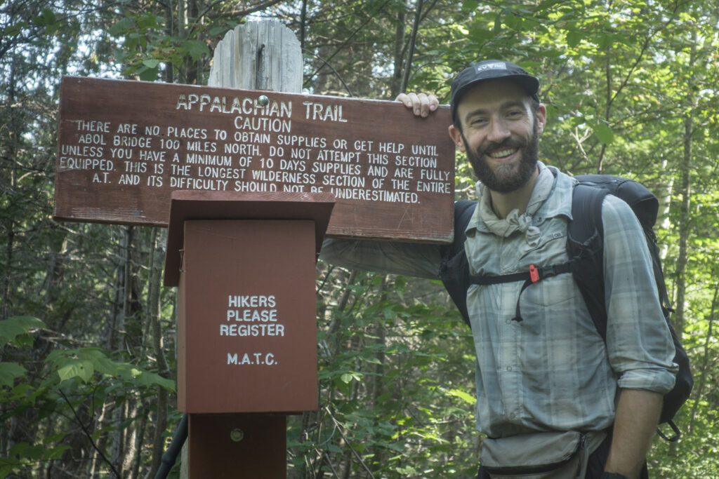
I woke up to the unpleasant tip-tapping sound of rain on my tarp this morning. But I packed up and got going and found that, as usual, it wasn’t quite as bad as it sounded. When I got to NH Route 25, I made a quick pit stop at Hikers Welcome Hostel to eat, resupply, and recharge and then set off for the afternoon up Mount Moosilauke, the first of the higher-elevation peaks in the White Mountains for northbounders on the Appalachian Trail.
I made my way up the steep ascent in the mist, realizing that the sun was unexpectedly but thankfully starting to peak through. As the skies cleared, the flora changed continuously as I gained elevation. The trees got smaller and smaller until eventually…there were no more trees and I was out in the open with just the wind-swept grass, the cairns marking my way, and endless views of the landscape falling away from me in all directions. My first time in a real alpine environment in a very long while. The beauty and scale of it all caught me off guard and I cried real tears at the sight.
It’s not that it was the most beautiful mountain I’ve ever been on in my life. I guess it’s just that I’ve been walking for 1800 miles now, up and over wooded mountains, lucky to catch a glimpse of the landscape around me through a gap in the trees. I’ve grinded it out through forests and pastures and certainly enjoyed the experience for what it was. But I suppose that the constant tree canopy and the way the landscape surrounded me served as a buffer between me and the world around me. But up here on Moosilauke with nothing but the wind and the rocks and the feeling like I was on top of the world, all the emotion that was behind the hard work to get here was just let loose.
The descent of the mountain was some of the most technically challenging hiking I’ve done on this journey. The whole way down, Beaver Brook cascaded continuously down the rock right beside the trail. It was a real treat to see almost 1,700 vertical feet of waterfalls from up close. I set up camp for the night in the hills north of Kinsman Notch as a gnarly storm boomed in the distance.
Day 72 | 20 miles | 1804-1824
I tried to figure out what the weather was doing as I made my way over the viewless Mount Wolf first thing this morning. Although there didn’t seem to be any clouds, I was socked in by a thick haze. I realized that it was caused by smoke being blown in from wildfires raging in the West. It was sad to think about how much devastation the fires must be causing if I could sense the effects all the way out here.
The technicality of the hiking has gone way up for this section of the Appalachian Trail. It’s crazy steep, rocky, and eroded, and I find myself using my hands almost constantly. But it’s engaging and very rewarding, and I’m welcoming the challenge so far.
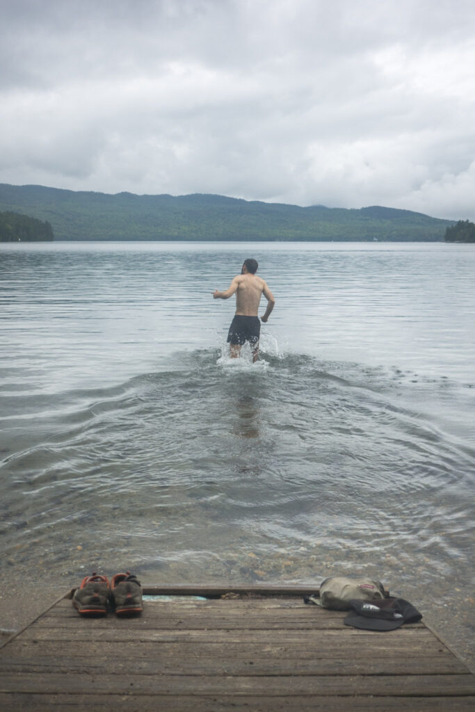
In the afternoon, I made the climb up to Kinsman Mountain. It was a steep ascent right beside the cascading Eliza Brook which made a series of perfect swimming holes that felt so nice and refreshing to dip into.
What would have been panoramic views from the summit of Kinsman were obscured by the haze, so I didn’t linger and descended the ridge towards Lonesome Lake. There, I encountered the first of many huts operated by the Appalachian Mountain Club along the AT in the Whites. Quite unlike the three-sided shelters that are along the entire AT, the huts are full-service setups with staff that cook and clean for visitors. It costs about $150 per night to stay there, which means that I and other thruhikers will usually opt to stay on a free patch of dirt instead.
But still, I stopped in and was stoked to be able to buy some fresh baked goods and check the place out; it was very charming. The staff were also cool enough to give me some leftovers from breakfast for free.
Refueled with all that fresh food, I descended from the lake down to Interstate 93. In the evening, I worked my way up the other side of the valley past Liberty Springs and set up camp just below Franconia Ridge, all set up to head up there to see the sunrise tomorrow.
Day 73 | 27 miles | 1824-1851
I woke up to my alarm in the pre-dawn darkness in my campsite below treeline on Franconia Ridge, excited to get into the alpine and check out the sunrise from what I had read was one of the most scenic sections on the whole AT. When it was finally light enough to see the conditions, I realized there would be no sunrise from up there; I walked out of the trees and into a cloud.
So I traversed the peaks of the Franconia Range – Lincoln, Lafayette, and Garfield – in near zero visibility. In every direction, the earth disappeared into grey, and I could just make out the silhouette of the cairns ahead of me to mark the direction I was headed. The wind howled over the ridge and blew the cold morning air over the alpine grass and around me.
It would have been cool to be able to see more, but I enjoyed the otherworldly experience I had up there, made especially so because I had the entire ridge to myself, which I think is pretty rare. In the end, just as I was about to descend back into the trees, a gap in the clouds blew through, and for a few moments I was able to see the ridge ahead of me and the mountains to the east glowing in the morning sunshine.
I made my down from the Franconias to Galehead Hut, where I stopped for a quick coffee and snack before heading up into the Twin mountain range. By the time I made it up to the ridge, the sun had come out and I enjoyed panoramic views from the summit of South Twin. North of there, the trail was easy and I bombed down to Route 302, stopping at Zealand Falls Hut for some fresh apple muffins. I’m loving the opportunities to pick up baked goods at the huts!
After crossing the highway, I made the big climb up to Mount Webster, past the breathtaking viewpoints at Webster Cliffs. I did the final summit scramble by headlamp as the sun was setting, taking in the view of the valley below me the whole way up. It was an exhilarating way to end the day.
Because the forecast for tomorrow is good, doing such a big day today has put me in a good position to go over the Presidential range – infamous for bad weather – tomorrow in good conditions.
Day 74 | 19 miles | 1851-1870
I had a really cold sleep in my tent up on Mount Webster last night. It was my third night in a row sleeping at around 4,000 ft in damp conditions, and it was taking a toll on my down sleeping bag. Despite that, when my alarm went off before dawn, I was fired up for my day traversing the Presidential range.
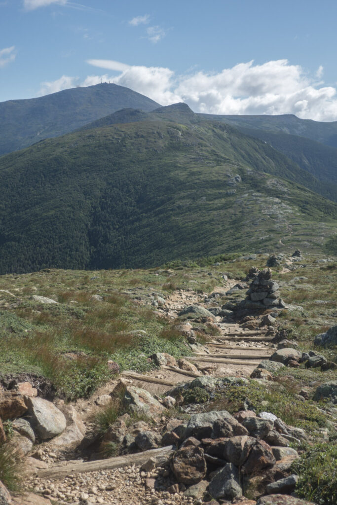
The Presidentials are notorious for the potential for really awful and dangerous weather, and AT thruhikers are often warned and concerned for what they could encounter up there. Wind speeds higher than 200 mph have famously been measured on the summit of Mount Washington, the highest in the range at 6288 feet. Thankfully, I would deal with none of that, and have one of the best days in the mountains of my life traversing those peaks in perfect conditions.
I summited all of the presidents – Pierce, Jackson, Eisenhower, Monroe, Washington, Jefferson, Adams, and Madison – one after the other. I moved as quickly as I could over the steep trail, but I stopped lots to soak in the views all around me and take pictures along the way. I loved the way that I could see the AT winding its way on the ridge as I went along. All in all, it was 15 miles continuously above treeline.
Mount Washington itself was a different experience. Although hiking up felt like a feat, a cog railway ferries tourists up and down the mountain, so there were hundreds of people at the summit eating at the cafeteria, shopping at the gift shop, and even making a queue to take a photo with the summit sign.
I also stopped at every AMC hut along the way – Mitzpah, Lake of the Clouds, and Madison Spring – for fresh cake and hot coffee. The crew at Lake of the Clouds even let me eat as much breakfast leftovers as I wanted in exchange for sweeping the dining room.
At the end of it all, I made the long descent from Mount Madison as the fading sun lit up the ridge in gold, feeling completely content. Days like today are what backpacking dreams are made of. I feel so fortunate be in this beautiful land, on trail built in the perfect spot, and under perfect conditions.
Day 75 | 25 miles | 1870-1895
I woke up at my campsite near Parapet Brook before dawn for the third morning in a row. It would have been nice to take a chill day after my two last big efforts, but the forecast was calling for rain tonight and I wanted to get out of the bigger White Mountains before it came. Anyway, it was too cold to sleep in, so I bombed down to the Pinkham Notch Visitor Centre, where the AMC cooks up a great breakfast buffet. I filled my belly and even packed out chocolate chip muffins for the road.
It was a sunny morning to tackle the steep climb up from the notch up to Wildcat Mountain. It was tough and a bit scrambly, like so many other climbs in the Whites. From the top, I got a great view of my route for the day ahead: steep down to Carter Notch, straight back up to Carter Dome, many ups and downs in the Carter-Moriah Range, and then a very long way down to the Androscoggin River valley. It was kind of intimidating to see it all laid out like that, to be honest.
So I went down and enjoyed some delicious soup at the Carter Notch Hut, the last of the AMC huts I’ll be visiting. I’m going to miss stopping at those huts every day for fresh food! There, I met three other hikers name Couscous, Sequoia, and Platypus that I would end up hiking the rest of the day with.
Clouds had been gathering all afternoon, and as I was coming down off the Carters, it started raining. Because the trail was steep and rocky, the potential to slip and fall made the hiking slow going. It was tough and I was really happy to have my hiking partners to help keep morale up.
We made the long descent off Mount Moriah together by headlamp and showed up at the Rattle River Hostel pretty wet. It was great to have a dry place and a hot shower waiting for us at the end of the long day.
Day 76 | 21 miles | 1895-1916
I started the day off enjoying hot coffee and pancakes around the table with a big group of hikers at Rattle River Hostel. Both northbounders and southbounders swapped stories and intel about their hikes and the trail.
I got going later than usual, which I would come to regret later in the day, and climbed out of the Androscoggin Valley into the Mahoosuc mountain range. Up there, it drizzled rain most of the day, the wind picked up, and morale was low as the terrain alternated between muddy and wet, rocky and steep, and overgrown.
I’ve been burning the candle at both ends on this section with big days and poor sleep recently and I guess it’s catching up to me. But I’ve been letting the forecast guide me to hit the most challenging terrain in dry conditions, and it’s served me great so far, so I’ll keep grinding it out for now.
In the early evening, I walked out of New Hampshire and into Maine, the final state of my journey. It probably should have been a moment of celebration, but I was honestly so over this day by then. Ankle-deep mud had given way to knee-deep alpine bogs. The trail frequently dumped me out onto sloped granite slabs with water running down them. And to top it all off, a cold, damp wind blew hard across the trail the whole time. There was a lot of cursing, and I ate way more than my day’s rations of junk food to cope.
Later in the evening, as the sun was getting low, the trail went up to around treeline for a couple miles, and the wind that had been just unpleasant most of the day turned to downright extreme. The upshot was that whether I was enjoying myself no longer felt like a concern and I just knew that I just needed to get down to lower elevations where I could set up camp somewhere sheltered. I hustled down by headlamp and made it to Full Goose Shelter and set up my tarp, finally feeling cozy and secure. Ironically, those last miles during which my instincts took over were the best I felt all day.
Well, tomorrow’s another day, and I’m looking forward to continuing through the Mahoosucs in what is forecasted to be better conditions.
Day 77 | 16 miles | 1916-1932
I woke up this morning camping at Full Goose Shelter freezing cold and not having slept much. Starting my day shivering and in the clouds and wind, I was not in a good headspace to be heading into what I knew would be challenging terrain. But as I got moving and the sun started peaking out, I started to feel better about the day ahead.
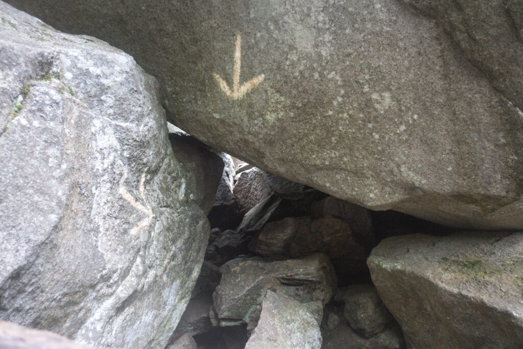
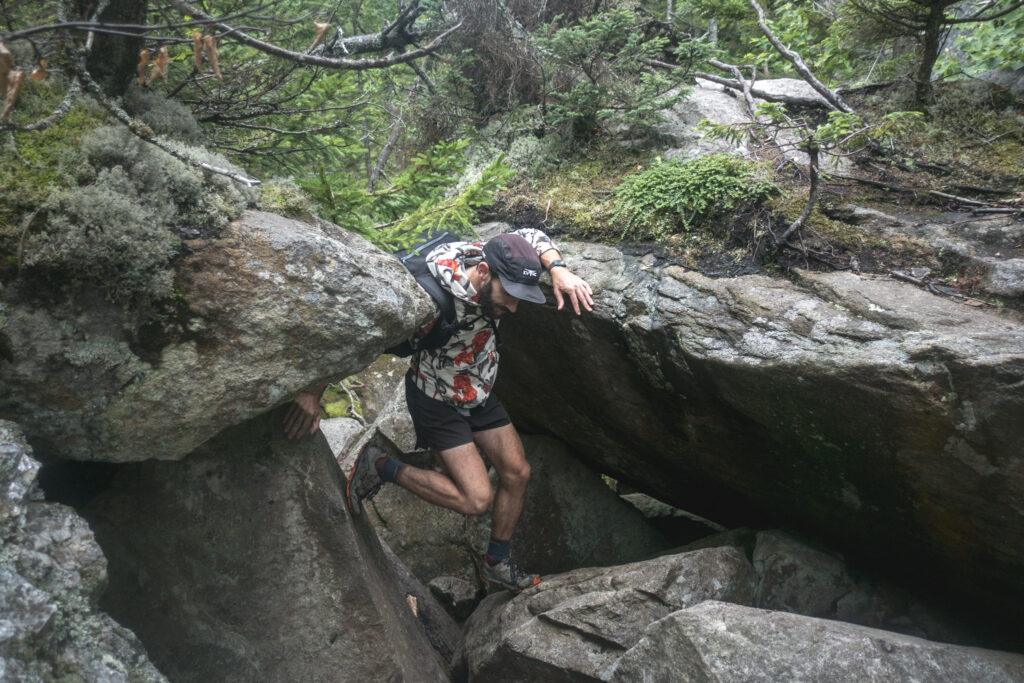
Within a couple miles, I stepped into Mahoosuc Notch, a spot between two mountains that’s filled with boulders the size of cars and often called the “hardest mile on the Appalachian Trail”. I climbed over, crawled under, or squeezed between those boulders. Sometimes, the spots were so tight that I had to take off my pack, push it through, and follow behind. It was a really unique and engaging challenge and I actually had a ton of fun going through.
Without even a break, the trail left the Notch and started a steep climb up the rocky slabs of the Mahoosuc Arm. Thankfully, the rock was mostly dry.
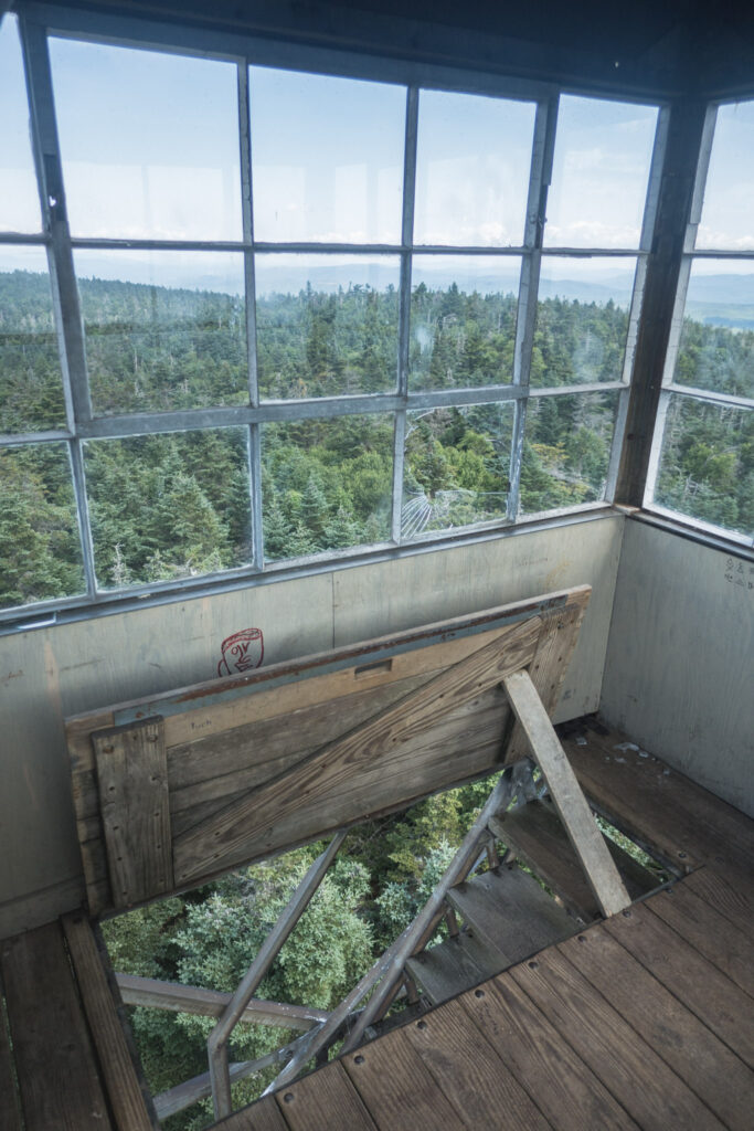
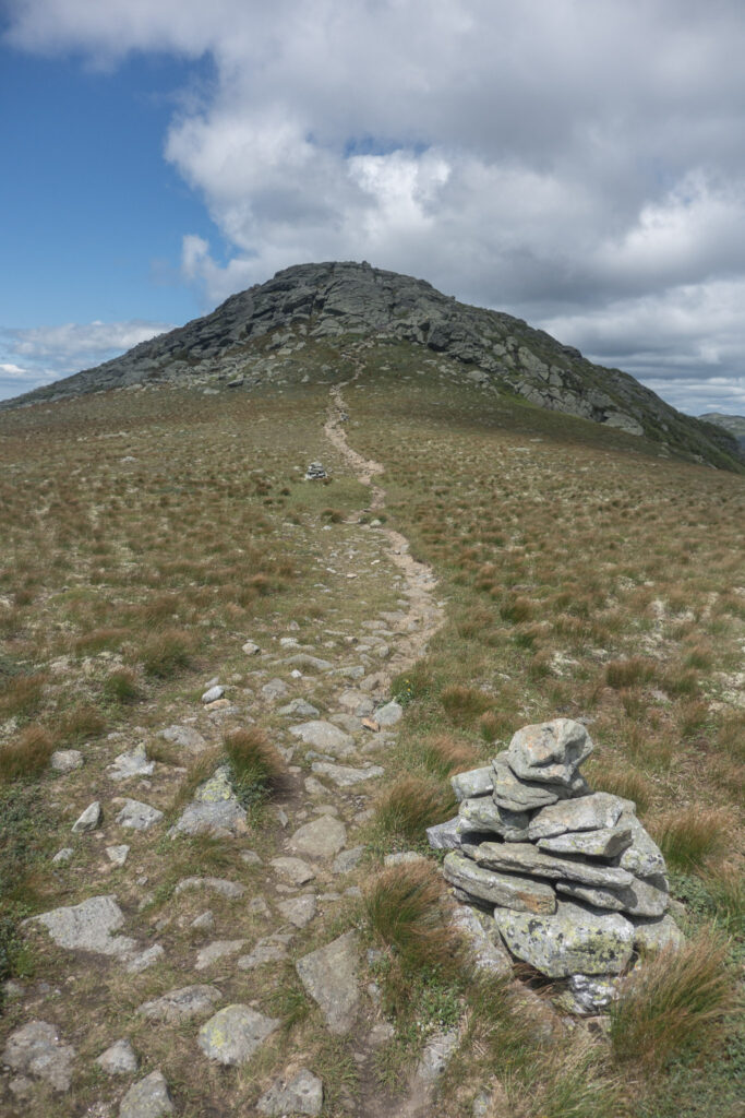
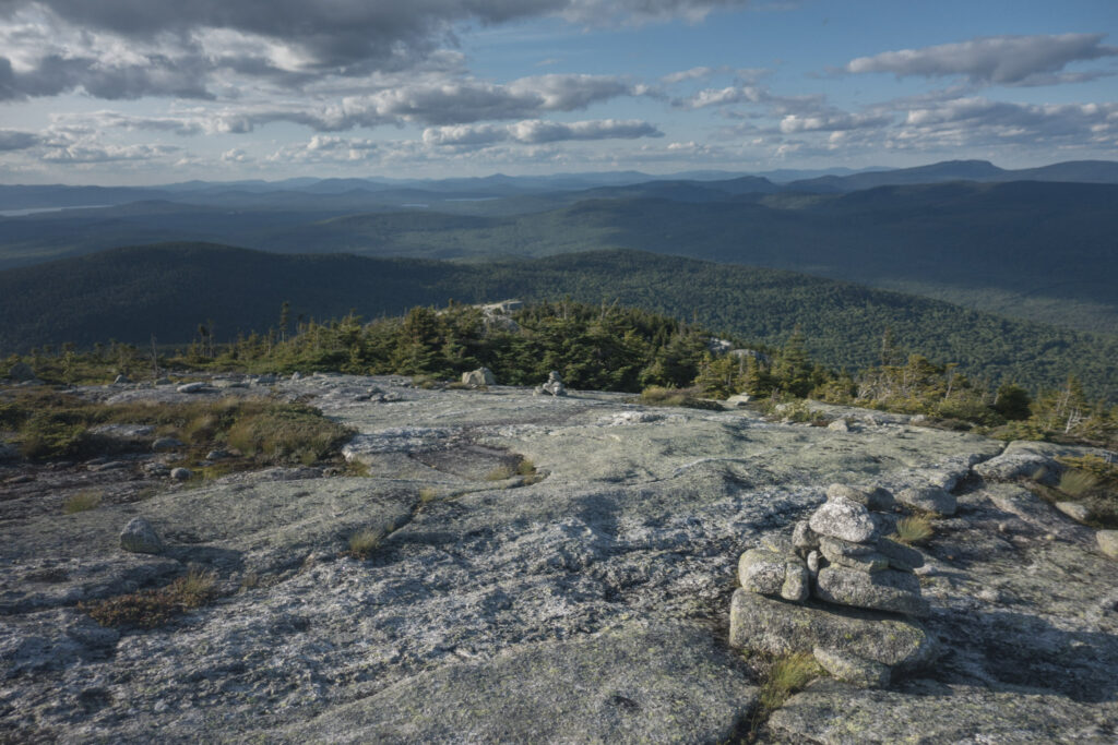
By the time I got to the top of the arm, I was under blue skies and could enjoy the views of the Maine landscape I had missed out on yesterday. From the arm, the trail passed through alpine bogs past Speck Pond and then up to Old Speck Mountain, which was on low-angle rock out in the very windy alpine. On the summit of Old Speck, I climbed the ladder up the fire tower and could see all the way to the horizon in every direction. To the south, I could see all the way to the Presidentials, and every other mountain range I had walked over the last three days.
I made the very long descent down to Grafton Notch, passing a ton of dayhikers on the way down. When I got to Grafton, I crossed the road and went straight back up about 3,000 ft to Baldpate Mountain. It was a set of twin peaks joined by a saddle, basically just a huge open area of rock and alpine flora with only cairns marking the way for the AT. It was an inspiring place to be, and it made my day when two former thruhikers out for a trail run named Roadrunner and Tea Berry came by and offered me two Snickers. At the end of the day, I ended earlier than usual and snagged a spot at the Frye Notch Shelter.
Day 78| 27 miles | 1932-1959
I woke up at the Frye Notch Shelter and packed up and left a bit after sunrise for a beautiful sunny morning of hiking in Maine. My first stop was a side trip up to Upper Dunn Falls, a cascade that created a bunch of perfect swimming holes, one of which was even deep enough to jump right into. It was such a refreshing way to start the day.
Since I crossed into the section of trail built by the Maine Appalachian Trail Club yesterday and left behind the one built by the Appalachian Mountain Club, the walking feels so different. And as the trail and the landscape change around me, it’s really setting in how close I am to the end of this journey. I’m excited to reach the finish and go back to the comforts of home. But, especially since this isn’t my first thruhike, I’m not taking a single mile of these last days for granted. Pretty soon, the sense of freedom and access to nature that have been my life all summer will come to an end.
I walked up and down all day over the wooded summits of Wyman Mountain, Moody Mountain, Old Blue Mountain, and Bemis Mountain. The trail was mostly forested, but the top of each peak gave a taste of alpine scenery.
Summiting Bemis Mountain around sunset was a really fun experience. The trees thinned way out and gave way to alpine flora, and the blazes and cairns guided me around the broad granite summit through what felt like a labyrinth of lichen and blueberries, which I ate my fill of as I walked. From there, I made the descent by headlamp down to Bemis Mountain Road to make camp.
Although the hiking today was relatively easy compared to my last few days, I really had to push myself to get it done. I’m really sleep deprived because of how cold the nights have been, and I’m pretty underfed because of my rushed and poor judgement packing my resupply a couple days ago, although the blueberries today helped. So I’m planning on a short day into the Hiker Hut hostel tomorrow to fix both of those situations.
Day 79 | 14 miles | 1959-1973
The nighttime temps were finally high enough for me to get a good sleep in my camp next to Bemis Mountain Road, which was a blessing. But when I woke up, I heard the sound of heavy rain on my tarp and decided to go back to sleep in the hope of waiting it out, and it did stop after not too long.
I got up and made the climb up to the scenic road lookout at ME Route 17, which didn’t seem very scenic at all in since I was socked in by fog. From there on, the trail was relatively flat, but it was still slow going because of how root-covered it was, made even trickier by the wet and slippery conditions. The other challenge I was facing today was the fact that I had finished my last bit of food last night, so I was doing the day’s hiking on nothing but instant coffee, hopes and dreams, and whatever I could forage along the way.
I walked by the huge and tranquil Long Pond, which actually had a sandy beach access, so rare for the backcountry. I opted not to swim because of the meh weather, but appreciated the possibilities.
After that, I worked my way up Piper Mountain and at the top, was really stoked to find a power line corridor where the trail was flanked by both blueberry and raspberry bushes! I picked a handful before moving on.
Getting through the last couple days, given how hungry I was, was a tough challenge to overcome. I’ve of course learned the practical lesson of packing a better resupply, which I’ll do on the next leg of this hike. But I also learned just how much my mind and body can do when I really need them to. I wouldn’t go around having these types of experiences on purpose too often, but I guess they’re when we learn what we’re really made of, and one of the reasons we leave the comforts of home in the first place.
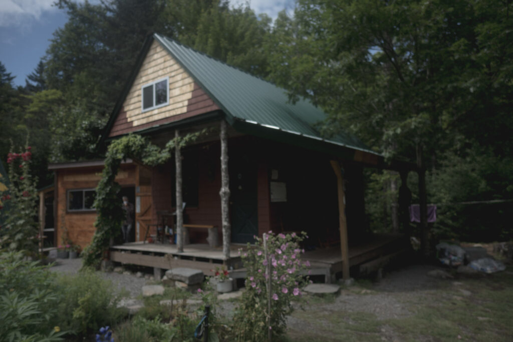
I made it through the morning of hungry hiking and found myself in the early afternoon at the Hiker Hut, a tranquil hostel in the woods not far from the trail that’s entirely off the grid, including a propane-powered shower on the river bank, making for the perfect place to lay low and recharge my body and spirit for the days of hiking ahead.
Day 80 | 25 miles | 1973-1998
I was the first one up at the Hiker Hut hostel this morning, and got to chatting with the owner Steve while he cooked me a couple of his famous breakfast sandwiches. He told me about how he used to be a professional triathlete so we were able to make a connection through our mutual interest in athletics. But then we talked about the trail and he had clearly done some serious thinking about the spiritual side of thruhiking and other parts of life. I could tell that he was a well of wisdom and that there were hours or even days of good conversation to be had, but by that point in the morning other hikers were looking for sandwiches and it was time for me to get going, as it always eventually is in this transient lifestyle.
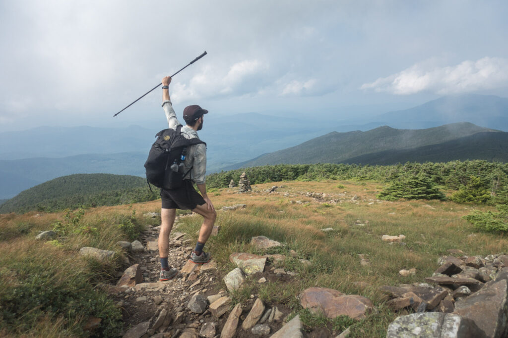
With my belly and pack full of food, Steve’s attitude in my head, and blue skies above, I was stoked to start my hike up Saddleback Mountain. At the top, the trail was in the open environment of the alpine for nearly three straight miles, with views in all directions. Blueberries grew all over too, but the plants were unique in the very high alpine in that they were never more than a couple inches tall, but still produced an abundance of fruit just above the ground.
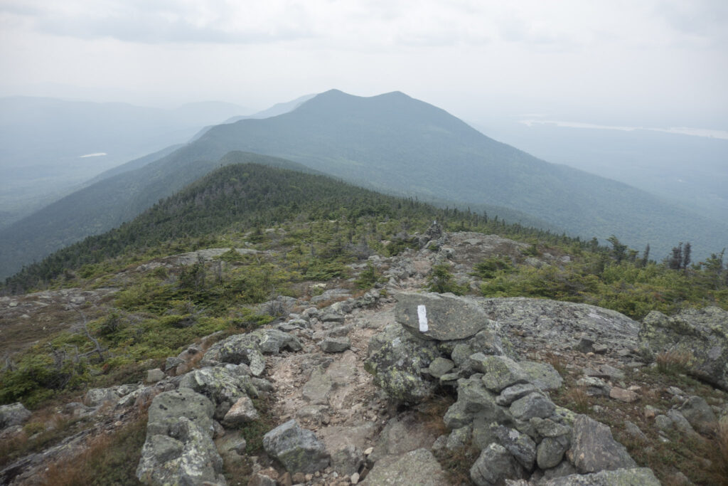
After Saddleback Mountain itself, I went over the other mountains in the range, including The Horn and Saddleback Junior. It was such a fun morning, a freeing and wonder-filled experience similar to what I felt up in the Presidentials last week, except up here it was just me and a few other parties of thruhikers that had the whole area as our own little playground.
In the afternoon, I climbed up to the ridge below Sugarloaf Mountain. On the way up, I spotted some decent swimming holes in the cascading Sluice Brook and almost didn’t stop, worried about making miles for the day. And then I remembered that this was my last week of being able to dip into mountain brooks every day, so I went into the refreshing water and I’m glad I did.
In the evening, I made the long descent down from the Sugarloaf area, finishing up by headlamp and setting up at the Crocker Cirque Campsite.
Day 81 | 27 miles | 1998-2025
For the first time in what felt like weeks, I had a comfortable, warm sleep outdoors last night. I’m relieved that the cold snap the area has been experiencing seems to be over. I started my day with climbs up South and North Crocker Mountains. From the top, there were a few potential views of the valley below, but the haze of wildfire smoke blocked the sight.
One thing I’ve noticed about the last few days of hiking in Maine is how quiet it is. From the mountaintops, I look over the landscape and see basically nothing but forest and sometimes hear nothing at all. It’s definitely one of the most peaceful places I’ve ever been.
On the way down from the Crockers, I passed the 2000-mile mark of my journey. I took a break to sit and reflect on the immensity of the experience that was behind me, including the many trials and challenges, and just the sheer volume of beautiful sights and feelings that have made up this hike.
From the Crockers, the AT crossed ME Route 27 and went straight up into the Bigelows, a mountain range with plenty of tough hiking, but completely worthwhile scenery. I followed a series of peaks along a relatively narrow (for Appalachia) ridgeline in the alpine. In spite of the smoke, the views on both sides of the ridge, out to endless forests and lakes, were incredible. As usual, I enjoyed wild blueberries along the way.
In the evening, It was a bummer to realize that my water filter that I keep in my side pocket was missing, probably having got caught on a tree branch somewhere in the last few miles. I decided that it would have been simply too heartbreaking to turn around and hike south to look for it, so I’d just be using prayers and my judgement around water sources to prevent water-borne illness for the next couple days.
I pushed for a couple hours after sunset by headlamp, which isn’t all that fun on the AT because of how the technical the trail is. But if I wanted to catch the ferry across the Kennebec River tomorrow afternoon before it stopped running for the day, I needed to make a few extra miles, finally setting up camp next to Jerome Brook.
Day 82 | 31 miles | 2025-2056
I woke up well before sunrise today, figuring that I had a big morning ahead of me if I wanted to get to the Kennebec River on time to catch the ferry. So I got moving and was surprised by, and thankful for, how easy the terrain was. I seemed to be out of the mountains for the first time in weeks, and instead walked past forested lakes and through bogs on boardwalks.
The lakes I walked past today were a pleasure to find. Especially after seeing nothing like them along the trail for months, I loved listening to the water lap against the shore and being able to look across and check out what’s going on on the other side, thousands of feet away.
Because the terrain was so easy, I made it to the river with a couple hours to spare, and had a fun guided paddle across. At the end, the guide, who goes by the nickname the King in the North, did this funny ceremony with his paddle and some river water, blessing me to have safe travels through Maine.
I was enough ahead of schedule that I decided to make a side trip and walk through the tiny village of Caratunk (population 63) and pick up some extra resupply from the general store. Although adding 3 extra miles on pavement is never my idea of a good time, the hiker hunger is insatiable at this point.
I continued north on the other side of the Kennebec where the AT got a little more challenging as I worked my way up towards Pleasant Pond. The trail to the pond was single track through the forest and it totally felt like I was on my own in the wilderness as usual. Imagine my surprise when I walked out to the beach for a swim and found that I was surrounded on both sides by dozens of homes with docks and power boats. I had apparently walked into the heart of Maine cottage country without even realizing it. The lake was warm, clear, and had a sandy bottom; it was the perfect spot.
In the evening, I summited Pleasant Pond Mountain to see some partial views between the trees, and then bombed down some more easy trails during a stellar sunset and made camp not far from the Bald Mountain Shelter.
Day 83 | 19 miles | 2056-2075
Something about hiking into Monson, the northernmost town on the Appalachian Trail and the final checkpoint on my journey, was just so exciting to me. So much so that I woke up at 2 o’clock in the morning and couldn’t go back to sleep. I laid there for a while in the dark but then finally figured if I was up I may as well just start hiking.
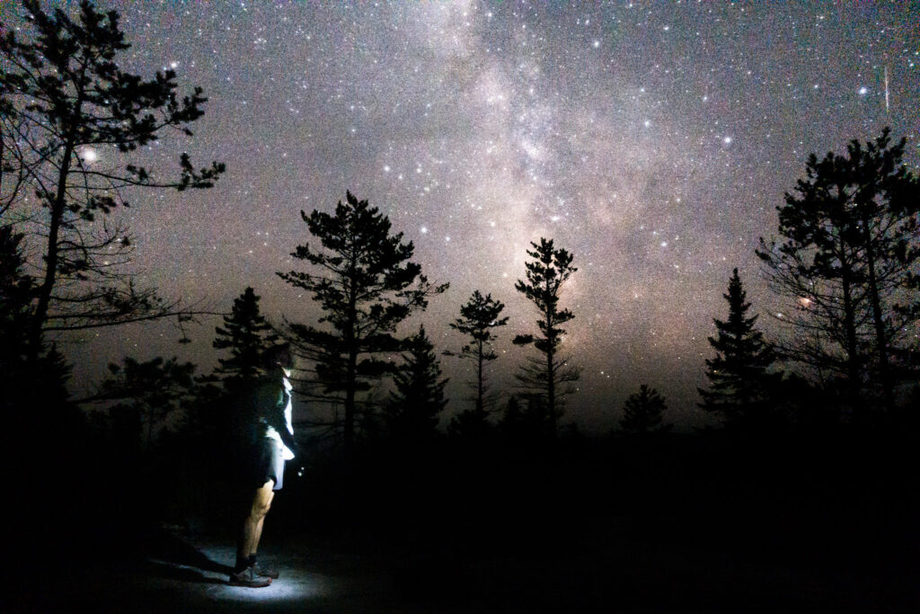
So I set off by headlamp in the wee hours. It was a little spooky, but every time I looked up and saw the river of stars twinkling through the space between the trees above me where the trail was cut was magical. I made my way over the open, alpine terrain of Moxie Bald Mountain as the stars faded in the rising sunlight.
And I had a moment of self-awareness as I was carefully stepping over some roots illuminated by my headlamp while spooning tuna into my mouth without breaking stride and I could only laugh when I realized how very silly my lifestyle had become.
I made a side trip to the north peak of Moxie Bald to watch an awe-inspiring sunrise over a cloud inversion, bathed in the moment, and then got back on the AT to head straight for town. I bombed down on more wonderfully easy trail as the sun got brighter and shined its light on all the foliage wet from yesterday’s rain.
I caught up with Platypus, a hiker that I had been leapfrogging with since New Hampshire, and we did the last few hours into town together, helping the miles go by with good conversation. We also surprisingly bumped into Scott Jurek, the legendary ultra runner and his wife Jenny, both authors of the great book “North” about the Appalachian Trail FKT. I had a very brief fanboy moment as we exchanged pleasantries without anyone really breaking stride on our respective hikes.
After that, I walked into Shaw’s Hostel, excited to rest and also bond with other hikers over the accomplishment of thousands of miles behind us, and the excitement over the last few miles ahead.
Day 84 | 24 miles | 2075-2099
I got a late start today, enjoying a hearty breakfast around the dining table at Shaw’s Hostel. It’s a pretty impressive operation they have there, cooking up eggs, bacon, hash browns, and pancakes for about 30 hungry hikers in the same hour.
There was a great moment at the hostel when a hiker named Shades noticed my outfit and said “I used to wear that hiking shirt, but I ended up switching to a different one.” Long story short, he was the one that left this exact shirt in a hiker box in Duncannon, Pennsylvania where I picked it up to replace my tattered one, and have been hiking with ever since. And here it was, having caught up to its original owner 7 states later. He said he was happy the shirt would end up at Katahdin.
I left Shaw’s mid-morning and walked into the 100-Mile Wilderness, the most remote section of the Appalachian Trail and my home for the next few days. It was the first day in as long as I can remember that I would describe as “hot”, and by the afternoon I had worked up quite a sweat, so I went for a dip in the pools below Little Wilson Falls to cool off.
In the evening, there was a pretty intense thunderstorm that made everything soaking wet as I worked my way up to Barren Mountain. And the trail in this area wasn’t draining well at all, forming huge puddles that couldn’t be avoided. It wasn’t very pleasant but it didn’t last long and the sun was peaking through the clouds by the time I got to the top of the mountain.
I feel an overwhelming level of positivity about these upcoming final few days on trail and the thruhike as a whole. It’s a level of excitement and contentment that’s surprising even to me. What I’ve come to realize is that those consecutive weeks of rocks, bugs, mud, and rain that I dealt with in the middle of this trip were an integral part in making this the Hero’s Journey it’s become. It was overcoming those obstacles that’s making this final chapter so magical, and the entire story so meaningful.
Day 85 | 28 miles | 2099-2127
I woke up early and went through the unpleasant routine of putting on my clothes that were still wet from yesterday’s storm. Thankfully, the sun came out and I was able to dry off pretty quickly.
The day’s hiking started in the Chairback mountain range, which was pretty steep and made for some slow going. But I had some nice views from the peaks of the clouds in the valleys below being burned off by the morning sun.
After coming down from the Chairbacks, I stopped to go for a dip in Gulf Hagas Brook to cool off and feel refreshed before heading up into the White Cap mountains. The trail through the White Caps wasn’t steep, but there was enough elevation change that I was completely pooped by the end. But I was relieved to know that after I summited White Cap itself, there were no big mountains left on the Appalachian Trail except Katahdin.
I worked my way down the descent and was happy to find myself on easy trails at lower elevation all the way until I set up camp around Mountain View Pond. But I realized that the one major bummer of being out of the mountains is that the mosquitos were around for the first time in ages.
Day 86 | 50 miles | 2127-2177
As my journey nears its end, I wanted to try one final challenge. I felt like testing the skills and fitness I had acquired on the thruhike and seeing what I could do with it.
So I packed up camp in the dark and set off by headlamp. I walked along the shore of Crawford Pond as the cloudy sky grew brighter and the loons called out from across the water. The trail was blissfully flat and dry and I was having a ton of fun just cruising.
All morning and afternoon, I passed through peaceful forests and along the shores of several ponds and lakes, most with great sandy beaches. The only break I took all day was to sit on the beach at Nahmakanta Lake to rest and enjoy the scenery. I thought about how special it was to able to walk into a place like this and have it all to myself.
As the day went on, the trail got more root-covered and rocky and difficult, my pace slowed, and I found myself with miles to go as daylight faded. I watched the setting sun shine its orange light over Rainbow Lake and listened to the splashes of jumping fish.
The real challenge began when night fell, and navigating the roots and rocks of the trail by headlamp felt so clumsy. But it all paid off when I got up to the exposed granite dome called Rainbow Ledges under a clear, starry sky. I forgot about my mission for a while and just hung out there looking up in awe.
All those hours of stepping over roots in the dark were tough, but eventually around midnight I set up my bivy just south of Abol Bridge – the furthest I could legally go tonight without a permit to camp in Baxter State Park – to rest for a few hours before my big day. Tomorrow, unless some act of God prevents it, I will summit Mount Katahdin and complete my thruhike of the Appalachian Trail.
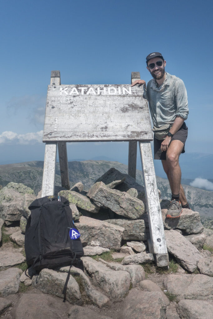
Day 87 | 16 miles | 2177-2193
All day, I reflected on the experiences I had in each of the 14 states that made up this journey. And around midday today, under clear blue skies, the emotions behind all of those experiences were let loose through tears as I summited Mount Katahdin and completed my thruhike of the Appalachian Trail.
I’m grateful for the land I passed through; the people that envisioned, built, and continue to maintain this trail; the support of my loved ones back home; and for my healthy body.
I’m very proud to have completed this hike in the self-supported style, meaning I didn’t once get into a car. That’s nearly three months and 2200 miles entirely human-powered, and except for a few hundred feet of paddling, all on my own two feet.
Finally, I’m grateful to you for following along. Knowing that you were out there getting something out of my photos and writing was one of the things that kept me going each day.
The End.